History

August 1, 2017

In 1894, the first bike lane in America was built on Brooklyn’s Ocean Parkway

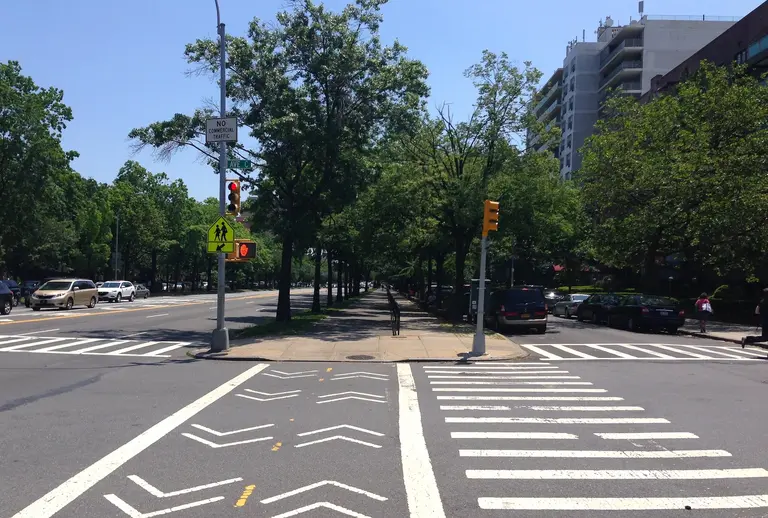
While many New Yorkers can be seen trekking through Brooklyn on their bikes today, the borough’s infatuation with cycling actually dates back to the 19th century. On June 15, 1894, Ocean Parkway became the first street in the U.S. to have a designated bike lane. The nearly five-mile stretch of road was designed by Frederick Law Olmsted and Calvert Vaux, the urban planning masterminds behind Central Park and Prospect Park. Originally, their design for Ocean Parkway was to be one of four spokes originating at Prospect Park and spanning across the borough. Today, the road doesn’t actually start at the park but runs parallel to Coney Island Avenue to reach the beach.
The full history this way
July 28, 2017

100 years ago today, the NAACP held its Silent Protest Parade down Fifth Avenue

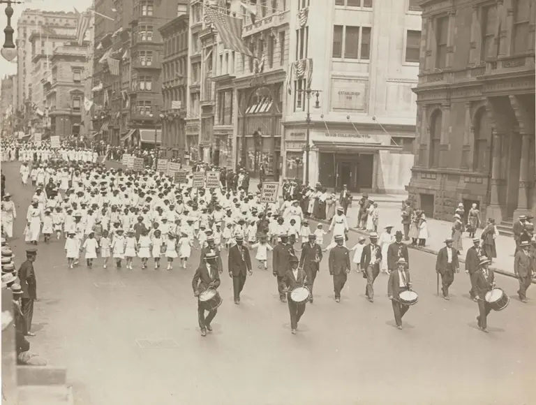
Forty-six years before Martin Luther King Jr. delivered his “I Have A Dream” speech during the March on Washington, nearly 10,000 African-Americans silently marched down Fifth Avenue to protest racial violence in the United States. Organized by the National Association for the Advancement of Colored People (NAACP), the Silent Protest Parade occurred on Saturday, July 28, 1917, and became the first mass civil rights demonstration of its kind. Protesters walked from 55th and 59th Streets to Madison Square, without so much as a whisper (h/t Hyperallergic).
Find out more
July 27, 2017

How a 15th-century French migration gave us the term ‘Bohemian’

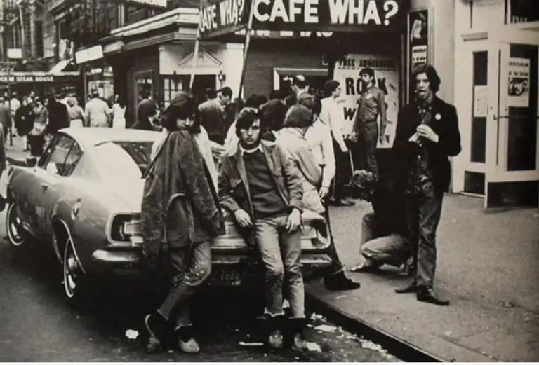
“Bohemian” may be hard to define, but we all know it when we see it. But even in a city like New York, where bohemian can be used to describe everything from a polished West Village cafe to a South Bronx squat, few people know why exactly we today use this term, connected to a medieval Central European kingdom, to describe those with a countercultural bent.
The whole history right this way
July 26, 2017

The history behind how Great Jones Street got its name

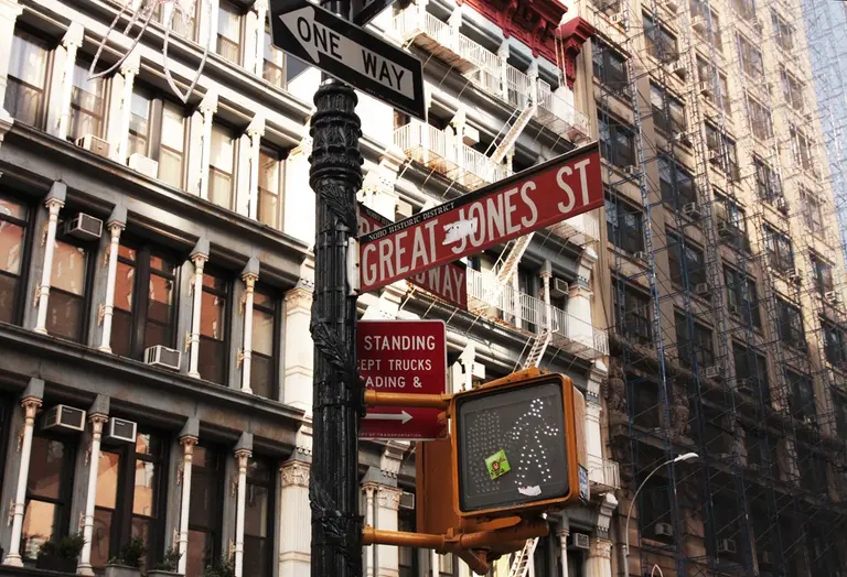
After 34 years of serving giant Cajun-Creole portions alongside obscure jukebox music, Great Jones Cafe is closing its doors for good tonight. The notorious Noho bar at 54 Great Jones Street opened in 1983 when the block was so empty patrons used be able to play whiffle ball in the street, but its closure serves as a reminder of the history of Great Jones Street. This superlative name dates way back to 1789 when politician Samuel Jones donated land to the city under the terms that they name any street within the property after him. But there was one little issue....
Where did the street name come from?
July 24, 2017

A rejected design for Central Park from 1858 shows colorful, whimsical topiaries

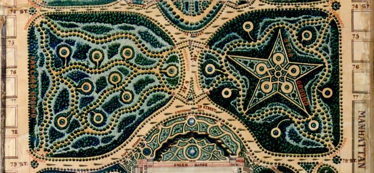
Central Park, which celebrated its 164th anniversary this month, required elaborate planning to make it what it is today: the most visited urban park in the country. New York City launched a design competition in 1857 for the development of the open space between Manhattan’s 59th and 110th Streets. Most New Yorkers know that out of 33 total entrants, the city chose Frederick Law Olmsted and Calvert Vaux's "Greensward Plan." However, just five of the losing designs survived and can be seen at the New York Historical Society. One particularly unique design was submitted by park engineer John Rink, who planned Central Park to be highly decorated with whimsically shaped sections dominated by topiaries (h/t Slate).
Find out more
July 20, 2017

Help the NYPL geotag historic photos of New York City

The New York Public Library has a challenge for all history gurus and NYC experts: Place unlabeled historic photos of the city at the correct location on a map. The new website called Surveyor crowdsources geotags of the NYPL's photo collections with the goal of creating a digital database to make it easier to find images by the location they were taken. While some photos come with helpful titles that describe the location or the address, others only include the neighborhood or vague details. Since algorithms and search engines won’t be able to pick up locations of these old photos, the NYPL is seeking help from the public.
Get more info
July 19, 2017

The history of Fort George: Manhattan’s long-lost amusement park in Inwood

Did you know Washington Heights and Inwood used to be home to a giant amusement park? In 1895, the Fort George Amusement Park opened on Amsterdam Avenue between 190th and 192nd Streets, overlooking the Harlem River in what is now Highbridge Park. Located in the same spot as George Washington’s fight against the British, "Harlem’s Coney Island" rivaled Brooklyn’s Coney Island with roller coasters, Ferris wheels, a skating rink, fortune tellers, music halls, casinos, and hotels.
Learn more about the Fort George Amusement Park
July 18, 2017

The world’s largest tire was used as a Ferris wheel at NYC’s 1964 World’s Fair

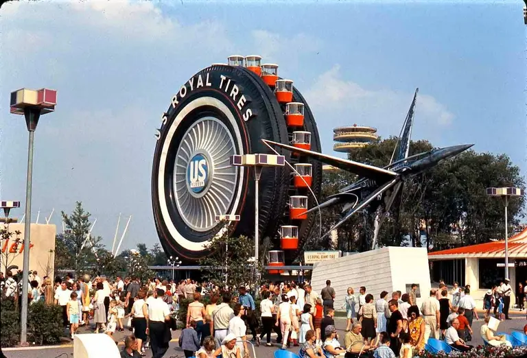
The world's largest tire, the Uniroyal Giant Tire, reached 80 feet high and weighed 20 tons when it debuted as a Ferris wheel at the New York World's Fair in 1964. First located in Flushing, Queens, the towering tire was commissioned by the Uniroyal Tire Company and designed by Shreve, Lamb & Harmon, the same architectural firm behind the Empire State Building. During its time at the fair, the tire carried over two million passengers, including Jacqueline Kennedy and her children, Telly Savalas, and the Shah of Iran. Each ride cost just $0.25 and would last 10 minutes.
How did the tire end up in Detroit?
July 17, 2017

Vintage maps reflect the population distribution of Americans in 1930

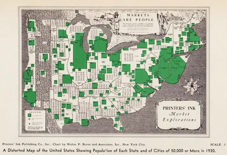
Using the 1930 census for their data, two distorted maps show where residents in the United States lived during this period of time. Both vintage cartogram maps exhibit how bunched Americans were in the north and the east coast, clustered in urban areas, despite the westward expansion of the previous century. As the Making Maps blog first featured and as Slate discovered, the size of New York and New Jersey grows in proportion to its expanding populations, moving further east into the ocean.
Find out more
July 17, 2017

Hess Triangle is NYC’s smallest piece of private land

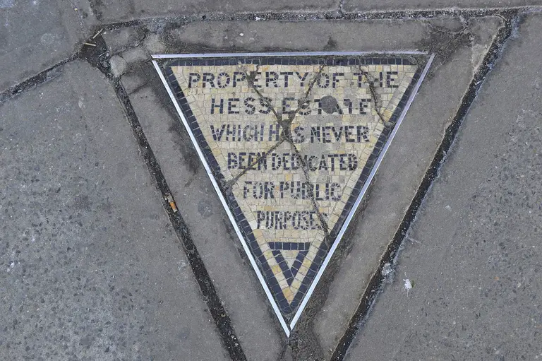
If you've ever walked by the busy intersection of 7th Avenue South and Christopher Street, you've likely seen people snapping photos of the iconic corner-facing Village Cigars, but what you probably didn't realize is that they were standing on top of New York City's smallest piece of private land. The Hess Triangle sits on the sidewalk at the southwest corner of this Greenwich Village crossing, a small concrete slab with an embedded mosaic that reads "Property of the Hess Estate Which Has Never Been Dedicated For Public Purposes."
Find out the story behind this cryptic message and one of the city's best historic remnants
July 14, 2017

On this day in 1645, a freed slave became the first non-Native settler to own land in Greenwich Village

In 1626, the Dutch West India Company imported 11 African slaves to New Amsterdam, beginning New York’s 200 year-period of slavery. One man in this group, Paolo d’Angola, would become the city’s first non-Native settler of Greenwich Village. As the Greenwich Village Society for Historic Preservation (GVSHP) discovered, and added to their Civil Rights and Social Justice Map, as a recently freed slave, d’Angola was granted land around today’s Washington Square Park for a farm. While this seems like a generous gesture from a slave owner, d’Angola’s land actually served as an intermediary spot between the European colonists and the American Indians, who sometimes raided settlements. This area, in addition to Chinatown, Little Italy, and SoHo, was known as the “Land of the Blacks.”
Find out more
July 14, 2017

The Urban Lens: Tour the grimy and crime-ridden subway of 1981

6sqft’s ongoing series The Urban Lens invites photographers to share work exploring a theme or a place within New York City. In this installment, we share a set of vintage photos documenting the NYC subway in 1981. Are you a photographer who’d like to see your work featured on The Urban Lens? Get in touch with us at [email protected]. Grim, gritty, grimy--these are just a few of the adjectives one could use to describe New York City in the 1980s. Homicide rates were at near-record highs, the crack epidemic had exploded, the police force had dwindled after the recession, and government mismanagement left the city on the brink of bankruptcy. At the time, a 22-year-old photographer from Florida named Christopher Morris was interning at the photo agency Black Star. According to TIME, he saw the graffiti-covered subway, dark, dank, and dangerous, as a battleground that "proved an opportunity to work on something of a domestic front line." Now an award-winning photojournalist, Morris recently rediscovered this set of shots that he took over six months in 1981, during which time he devoted himself to this unique, seedy underworld.
See his photo series ahead
July 12, 2017

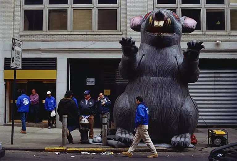
The story behind ‘Scabby the Rat,’ NYC’s symbol of unionized labor

Despite a nationwide decline in union membership, New York City continues to defy this trend. The number of city workers who belong to unions has risen for the last three years in a row, growing from 21.5 percent of all workers to 25.5 percent in 2016. And because of this high number of unionized employees, city residents have become even more familiar with Scabby the Rat--one of the most recognizable symbols of unions. The giant inflatable rodent, with its sharp buck teeth and beady red eyes, has been a staple of union construction protests in NYC and across the country for decades, and if there's a development project that enlists nonunion labor in New York, expect to see Scabby out on the street.
Find out more about Scabby's story
July 11, 2017

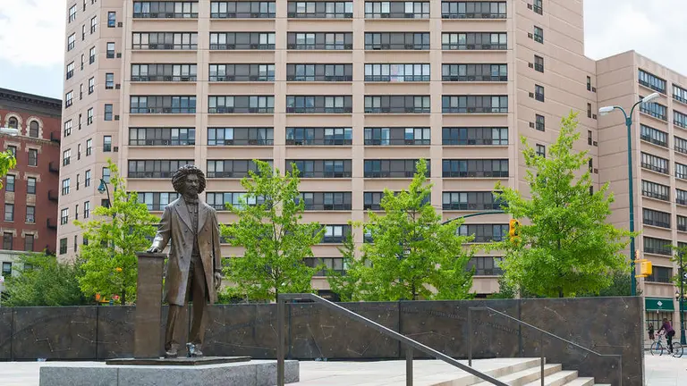
‘Talking Statues’ project brings NYC history to life with a new smartphone app

If statues could talk, what would they say? Thanks to a new project called New York Talking Statues, you will now be able to find out. Beginning tomorrow, July 12, New Yorkers will be able to listen to the voices of 35 statues across the city through a smartphone app (h/t Untapped Cities). Users will be able to scan the QR code found on a sign next to each statue or type in the web address into the web browser. The team behind the project chose the statues by looking at their historical significance to the city, especially those with a special tie to immigrant communities as well as artists who have contributed directly to the city.
Find out more
July 7, 2017

An architect’s 1969 nuclear shelter plan shows a mini-Manhattan built thousands of feet underground

The 1960s Cold War years were America's peak fear/fantasy period as far as the threat of nuclear weapons being deployed. Related scenarios played heavily in science fiction works and frequently surfaced in art and writing. On occasion the line between sci-fi and urban planning tends to blur, at least in hindsight; such is the case for architect and city planner Oscar Newman's probably tongue-in-cheek vision of an enormous spherical underground replica of Manhattan located thousands of feet below the city itself, to be switched into action in the event of a nuclear event. Atlas Obscura reveals Newman's fantastical map to a subterranean metropolis where New Yorkers would wait out the fallout.
Head underground for a look-see
July 7, 2017

The Urban Lens: Vintage NYC photos show everyday life in the 1940s

6sqft’s ongoing series The Urban Lens invites photographers to share work exploring a theme or a place within New York City. In this installment, we share a set of vintage photos documenting NYC in the 1940s. Are you a photographer who’d like to see your work featured on The Urban Lens? Get in touch with us at [email protected]. The 1940s were marked with both dark times and bright hopes. Nightly dim-outs, meant to both conserve energy and hide the skyline from possible WWII air and naval attacks, were a regular occurrence; police scuffled with citizens over race riots in Harlem and the AFL Strike on Wall Street; and President Roosevelt died. But towards the end of the decade, New Yorkers and the nation celebrated the end of the War; Times Square and Coney Island drew record crowds; and retail venues like the Fulton Fish Market and Orchard Street reached their height. Ahead, this collection of vintage photos showcases what everyday life was like in NYC in the 1940s, from the good times to the bad.
See all the photos here
July 6, 2017

VIDEOS: Watch footage from the Third Avenue El train’s last days in 1955

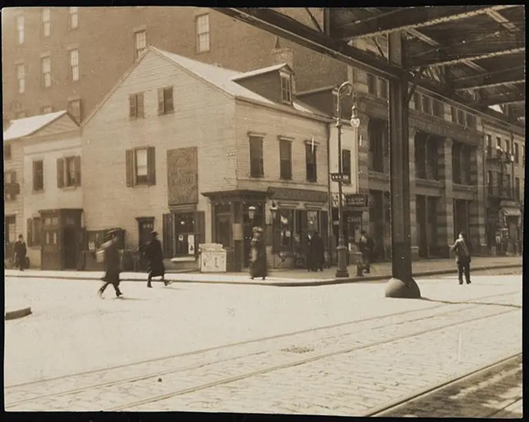
As a solution to Manhattan's rapid population growth and street congestion in the late 1800s, railroad companies decided to better serve their passengers by elevating the trains above ground. Originally, four elevated lines ran the length of Manhattan, but after complaints about the trains blocking light and emitting extremely loud noise, they suffered from a decrease in ridership. The elevated trains that ran along Second, Sixth and Ninth Avenues were all demolished between 1939 and 1942. The one line that stood its ground for a bit longer was the Third Avenue El, which was constructed between 1875 and 1878 and ran from South Ferry to Chatham Square before closing for good in 1955.
See the final days of the El train
June 28, 2017

INTERVIEW: The NYC LGBT Historic Sites Project talks gay history and advocacy in NYC

"Where did lesbian, gay, bisexual, and transgender (LGBT) history happen in New York City? In what buildings did influential LGBT activists and artists live and work, and on what streets did groups demonstrate for their equal rights?" These are the questions that the NYC LGBT Historic Sites Project is answering through a first-of-its-kind initiative to document historic and cultural sites associated with the LGBT community in the five boroughs. Through a map-based online archive, based on 25 years of research of advocacy, the group hopes to make "invisible history visible" by exploring sites related to everything from theater and art to social activism and health. To mark Pride Month, 6sqft recently talked with the Historic Sites Project's directors--architectural historian and preservation professor at Columbia Andrew S. Dolkart; historic preservation consultant Ken Lustbader; and former senior historian at the NYC Landmarks Preservation Commission Jay Shockley--along with their project manager, preservationist Amanda Davis, about the roots of the initiative, LGBT history in NYC, and the future of gay advocacy.
Read the interview here
June 27, 2017

In the 20th century, the subway system used professional sniffers to keep New Yorkers safe

Image © 6sqft The city's subways of today have machines that can test air samples and look for potentially dangerous gas build-up or biological and chemical agents. However, before such technology was invented, the city hired James “Smelly” Kelly to walk the tracks using just his nose and a few homemade inventions, to find and report any leaks or hazardous smells. As Atlas Obscura discovered, Kelly and his team would walk underground for allegedly ten miles of track each day, and by the end of his career, it is said Kelly walked over 100,000 miles of track.
Find out more
June 26, 2017

90 years ago today, Coney Island’s iconic Cyclone roller coaster opened

On June 26, 1927 the Coney Island Cyclone opened in Brooklyn. The iconic wooden coaster, located on the corner of Surf Avenue and West 10th Street, is one of the oldest functional amusement rides in the United States. While it only cost $.25 to ride when it first opened, today it costs about $10. Found at Luna Park, the coaster takes you over 2,640 feet of track at 60 miles per hour, with 12 drops (the highest an 85-foot, 60-degree plunge) and 27 elevation changes in roughly two minutes.
See a historic video of the coaster in action
June 23, 2017

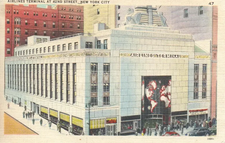
The history behind 42nd Street’s lost Airlines Terminal Building

For more than 30 years, the Art Deco-style Airlines Terminal Building served millions of travelers as a spot where flight tickets servicing New York could be purchased and where passengers could board shuttle buses to take them to the various airports. The building, located on the southwest corner of Park Avenue and 42nd Street, sat on the former site of the Hotel Belmont, which was built in 1906 and later demolished in 1930. Construction of the Airlines Terminal began in 1939 to create the chic, futuristic design, which included a steel frame and a crown flanked by two eagles.
Find out more
June 20, 2017

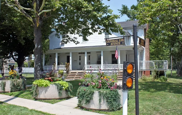
Politicians push for Brooklyn’s General Lee Avenue to be renamed

When four Confederate statues were removed in New Orleans last month, many sided with Mayor Mitch Landrieu's plan, but others felt it was an attempt to erase history. Nevertheless, the monuments all came down, prompting national elected officials to take notice--even here in NYC. As 6sqft previously explained, there exists a General Lee Avenue and a Stonewall Jackson Drive in Brooklyn's Fort Hamilton, the city's last remaining active-duty military base, and a group of local politicians has sent a letter to Army Secretary Robert Speer asking that they both be renamed, with Colin Powell and Harriet Tubman suggested as possible replacements (h/t Gothamist).
Get the full story
June 20, 2017

10 things you never knew about Prospect Park

Frederick Law Olmsted and Calvert Vaux debuted Prospect Park to the Brooklyn masses in 1867. Though Olmsted and Vaux had already designed Central Park, they considered this their masterpiece, and much of the pair's innovative landscape design is still on display across all 585 acres. But it was the result of a lengthy, complicated construction process (Olmsted and Vaux weren't even the original designers!) as well as investment and dedication from the city and local preservationists throughout the years. After challenges like demolition, neglect, and crime, the Parks Department has spent the past few decades not only maintaining the park but restoring as much of Olmsted and Vaux's vision as possible. It's safe to say that these days, Prospect Park is just as impressive as when it first opened to the public. And of course, throughout its history the park has had no shortage of stories, secrets and little-known facts. 6sqft divulges the 10 things you might not have known.
All the juicy secrets ahead