Transit

November 28, 2016

$1.7B BQE rehab will be Department of Transportation’s most expensive project ever

When it was built in the 1940s, the Brooklyn-Queens Expressway became immediately notorious for the fact that Robert Moses planned it to rip through otherwise quiet, low-scale neighborhoods. Today, it's poor reputation has more to do with potholes, bumps, congestion, and pollution. But that will soon change, as the city is embarking on a five-year rehab of the heavily trafficked, 1.5-mile stretch of the highway that runs between Atlantic Avenue and Sands Street in Brooklyn and includes "21 concrete-and-steel bridges over local roads," according to the Times. And at $1.7 billion, it will be the Department of Transportation's most expensive project ever undertaken.
More details ahead
November 21, 2016

Shipbuilding companies work around the clock to meet 2017 ferry service deadline

City officials are pushing to have the $325 million citywide ferry service, helmed by Hornblower and managed by the city's Economic Development Corporation, up and running a few months before next November, when Mayor Bill de Blasio stands for re-election. As 6sqft reported in September, two bayou-based shipbuilding companies, Horizon Shipbuilding in Bayou La Batre, Ala. and the awesomely-named Metal Shark in Franklin, La., are racing to complete the 19 new boats scheduled to hit the water this summer. The ferry service will be the most extensive passenger ferry service of its kind in any U.S. city.
Get a sneak peek at the shiny new fleet-to-be
November 17, 2016

In light of fare hikes, need for low-income Metro Cards becomes urgent

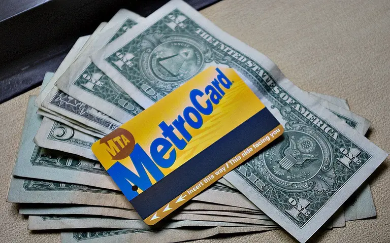
Fighters for the Fair Fare initiative to secure half-priced MetroCards for low-income New Yorkers strengthened their resolve Wednesday as the Metropolitan Transit Authority announced plans to increase fares by 25 cents early next year. The group argues that the brunt of bus and subway fare increases fall on the city’s low-income residents who might forego food, […]

November 16, 2016

Triboro’s ‘Wrong Color Subway Map’ uses art as an antidote for subway confusion

David Heasty and Stefanie Weigler, the husband-and-wife team behind Brooklyn’s Triboro design firm, want you to spend more time looking at the New York City subway map. To that end, they’ve created versions of the familiar underground map in vibrant colors that definitely aren’t part of the official MTA version. Intended as less of a subway map replacement and more of a "beautiful memento of the city," Triboro introduced their Wrong Color Subway Map this fall, citing Massimo Vignelli’s iconic 1972 design as inspiration (h/t Wall Street Journal).
More maps, this way
November 16, 2016

MTA mulls increasing subway fare to $3.00 in 2017

Swiping a MetroCard at a subway turnstile could cost an extra 25 cents in March, the Metropolitan Transportation Authority announced Wednesday. The MTA finance chairman has suggested to raise on fares on subways, buses and commuter rails, and tolls on bridges and tunnels, to help curb increasing debt. The proposed change would go into effect in March 2017. 
more info here
November 10, 2016

East River Skyway endorsed by local politicians as L train alternative

It looks like the East River Skyway is getting a big boost from local elected officials. Three politicians have jumped on the idea, including U.S. Congresswoman Carolyn Maloney, City Councilman Stephen Levin, and State Assemblyman Joseph Lentol. The trio together drafted a letter to Mayor de Blasio, encouraging him to back the transit initiative as a solution to impending L train closure. "This is the coolest thing we could do for the neighborhood," Lentol, told DNA Info. "I don’t want to denigrate the BQX but this is even a greater plan to have a gondola going from Brooklyn to Manhattan forever."
find out more here
November 7, 2016

MAP: Here’s what the NYC subway system looked like in 1939

We often think of the NYC subway as a relatively modern marvel, a system that has expanded and evolved tremendously over 100-plus years, and a shell of what it was when it first debuted in 1904. However, the reality is that the majority of the lines that make up today's network were actually built before The Great Depression. In fact, as graphic designer Jake Berman's insightful throwback map depicts, it was pretty much all systems go by 1939.
see the complete map here
November 7, 2016

Proposed Penn Station-topping free-fall ride gets new video, details

When developers at Brooklyn Capital Partners and designers at AE Superlab revealed their proposal to erect the world's tallest free-fall ride atop Penn Station, it seemed like perhaps a commentary on Governor Cuomo's big-ticket overhaul of the station. But in fact, the team hoped their 1,200-foot Halo, as it's being called, would rise along with the renovations, serving as "an interactive beacon for the city." As 6sqft reported, "the ride’s 11 cars... could be modified to move as quickly as 100 miles per hour giving it a top-to-base free fall of about six seconds." A freshly uncovered video shows this in action, and a new project website provides more details on the logistical components, 20-month construction time period, and $130 million in annual projected revenue.
Plenty more details this way
November 7, 2016

The W train returns today, see the MTA’s new service map

When it came to reviving the W train, the MTA surprisingly stuck to their timeline, with restored service from Astoria to lower Manhattan beginning at this morning. The train will now run from 6:30am to 11:30pm no weekdays, but this means changes on the N, R, and Q lines, which account for the Q train getting rerouted once the Second Avenue Subway opens next month. To make things a little simpler, the agency has created a handy map detailing the new service and changes, along with an infographic of station-specific information (h/t Gothamist).
See the full map here
November 2, 2016

14th Street and Williamsburg no-car zones proposed for L train shutdown

Transit advocacy groups and politicians who have been promoting the idea of ridding Manhattan’s 14th Street of private car traffic during planned L subway tunnel repairs, and only allowing bus, bike and pedestrian traffic, have also suggested that the no-auto plan would be good for Grand Street in Williamsburg, the New York Post reports. Grand Street is a major neighborhood thoroughfare similar to 14th Street, and advocates say giving the streets to bikes, pedestrians and shuttle buses would be one way to lessen the impact of the shutdown.
Find out more
November 2, 2016

City reveals maps of proposed routes for Brooklyn-Queen streetcar

When the plan for a streetcar from Brooklyn to Queens was officially announced by the city in February, we knew that the $2.5 billion line would run 16 miles along the East River, from Astoria to Sunset Park, but the exact routes have remained a mystery, up until now. The Times reports that yesterday the city released a 25-page report that outlines these key details, as well as how the streetcar would traverse bridges to cross Newtown Creek and the Gowanus Canal and more logistical details. It also includes maps for the various routes through each neighborhood with a list of pros and cons (road width, proximity to existing subway stations, street and pedestrian traffic) for each possible street.
See the maps
October 31, 2016

12 experts suggest creative ways to handle 9 million future New Yorkers

With New York City's population on its way to nine million, the city's infrastructure may be impressive, but it has its limits–including red tape and resource shortages–that will make it difficult to withstand the projected surge. Reminding us of the transformative innovations of Robert Moses–he of the big ideas and ego to match–Crains invited 12 firms who make their living wrangling infrastructure to hit us with some big ideas. Ahead of the upcoming summit, "Getting Ready for 9 Million New Yorkers," they've shared these visions for future (bigger, better) New York from top architects, designers and real estate experts. Ideas include some that have already proven themselves (repurposing existing track beds) and some already in the works (Bushwick's Rheingold brewery project) to others that Robert Moses might not love (shrinking the city's highways).
Take a look at these futuristic ideas for moving the city forward.
October 27, 2016

Independent engineer says two Second Avenue Subway stations are still far from ready

Despite MTA Chairman Tom Prendergast's seemingly unwavering optimism that the Second Avenue Subway will open on time, it's still not clear if the line's stations will be ready for their December ribbon cutting. According to the Times, following a Wednesday MTA board presentation outlining some of the outstanding issues (and the agency's commitment to smoothing them out over the next eight weeks), Kent Haggas, an independent engineer for the project, offered up a very somber outlook. As he told the paper, two of the three stations set to open December 31st have fallen behind, and that the system's "rigorous testing schedule was not being met." More alarmingly, he added that progress to date would need to be almost tripled on a weekly basis if the MTA is to meet its deadline.
Yikes
October 24, 2016

MTA puts up flyers touting the W train’s November 7th return

6sqft revealed last month that the W train would be making its triumphant return on Monday, November 7th, restoring service from Astoria to Lower Manhattan. Now that the date is only a couple weeks away, the MTA is putting up flyers touting the new re-instated line, reports Pix 11. Designed to look like a flashy Broadway marquee, the poster was spotted by a Reddit user over the weekend at the 34th Street-Penn Station platform of the A,C,E train.
Learn what this means for subway service
October 24, 2016

Second Avenue Subway will open in December without delay, officials say

MTA Chairman Thomas Prendergast is hoping to squash rumors that the Second Avenue Subway (SAS) will miss its December opening date. As Prendergast told the Times on Friday, “[we want to show riders] we live up to our promises” and that they are "now within striking distance of having it done.” The chairman's remarks incidentally coincide with some newly unearthed information from the Daily News, who also reported Friday that the agency spent a week shaving down parts of the new subway tunnel wall because 75-foot train cars couldn't fully clear curves.
more info from the MTA here
October 18, 2016

Approval process for new $24 billion Hudson River tunnels fast-tracked; construction could start in 2019

The $24 billion plan to construct two rail tunnels beneath the Hudson River has been designated a priority, which will get it fast-tracked through environmental and permitting stages and trim development time by a year or more, the Wall Street Journal reports; with construction beginning in 2019, the tunnels could be operational as early as 2024, U.S. Transportation Secretary Anthony Foxx said at a news conference at Penn Station on Friday. Both Amtrak and NJ Transit will use the new tunnels, which are among the first steps in a broader plan by Amtrak find ways to handle double the current number of passenger trains running beneath the Hudson River.
Find out more
October 10, 2016

VIDEO: MTA runs first test trains on Second Avenue Subway line!

While it's still unclear whether or not the Second Avenue Subway will meet its December opening date, it does look like the rails themselves are just about ready to take on riders. Over the weekend, Youtube user Dj Hammers spotted the agency running trains past the line's Lexington Avenue-63rd Street station (where a public area has already opened), testing out the third rail, signals and track.
more details and a video here
October 7, 2016

New interactive website gives grades to the city’s failing bus routes

The NYC Bus Turnaround Coalition--a recently formed partnership of transit advocacy groups who believe the city's bus system is broken--released a report over the summer that called on the city to make improvements to the system, which is one of the slowest in the nation. Their latest tactic to get the message across comes in the form of an interactive website that gives grades to all 307 bus routes based on speed, ridership, and bunching (when several buses arrive all at once), as Streetsblog explains. There's also animated visualizations that illustrate the annoyances bus riders deal with compared to a hypothetical look at life riding a system not plagued by delays, outdated routes, and unreliable service.
READ MORE
October 6, 2016

NYC bridges and tunnels getting $500M overhaul including LED light shows and electronic tollbooths

Gov. Andrew Cuomo announced Wednesday that the tolling system on the city’s bridges and tunnels owned by the MTA–that would be Robert F. Kennedy, Throgs Neck, Verrazano-Narrows, Bronx-Whitestone, Henry Hudson, Marine Parkway-Gil Hodges Memorial, and Cross Bay Veterans Memorial bridges and the Queens-Midtown and Hugh Carey (formerly Battery) tunnels–will be getting a $500 million overhaul. Cuomo also announced that the $500 million the MTA will asked to contribute to pay for the new collection system will also cover new LED lights on some of the city’s bridges.
Cashless tollbooths and disco bridges, this way
October 5, 2016

Apple Pay and Masterpass gets added to the MTA eTix

Beginning today, you won’t have to worry so much about “what’s in your wallet” before you hop on Metro-North Railroad and Long Island Rail Road. Govrnor Andrew Cuomo’s office announced on Tuesday the addition of Apple Pay and Masterpass digital wallet technology to MTA eTix, the mobile ticketing app. “By adding the use of cutting edge […]

October 5, 2016

POLL: Which Penn Station scheme do you prefer, Governor Cuomo’s or Vishaan Chakrabarti’s?

When Governor Cuomo revealed his plans for a new Penn Station-Moynihan Train Hall complex early last week, things seemed to be moving full steam towards a 2020 completion date thanks to flashy renderings and the selection of a high-profile developer-builder team. But architect Vishaan Chakrabarti was not convinced, and he and his firm the Practice for Architecture and Urbanism decided to create their own vision, one that repurposes Madison Square Garden, a facet of the plan he feels Cuomo failed to address.
Tell us which scheme you prefer
October 4, 2016

NYC bike lanes date back to 1899, and trucks blocked them then too

Vehicles parked smack in the middle of bike lanes are among the biggest scourges faced by city cyclists. It’s illegal (yes, there’s a $115 fine) though the law is rarely enforced–but it’s not just a modern obstruction. As it turns out, the main reason early bike lanes were created in the 1890s was because of lobbying by cyclists in the hopes getting more open riding space. New York City began paving whole streets and laying down asphalt strips specifically for cyclists–and, ironically, carts, wagons and other vehicles immediately began blocking them.
Naming and shaming the scofflaws