Transit

February 26, 2016

Port Authority Will Hold Opening Ceremony for WTC Transportation Hub After All

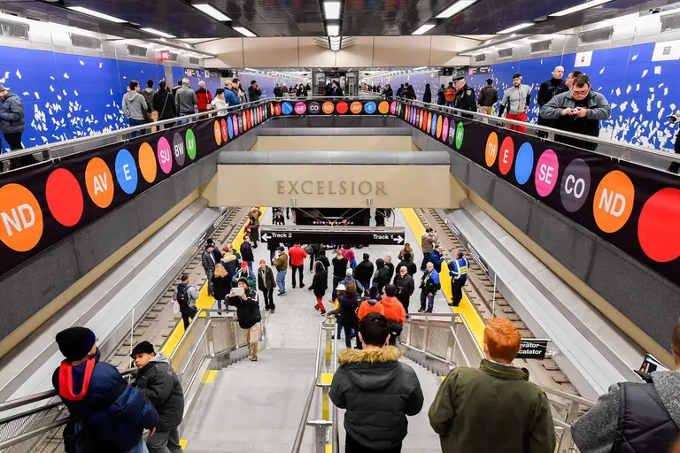
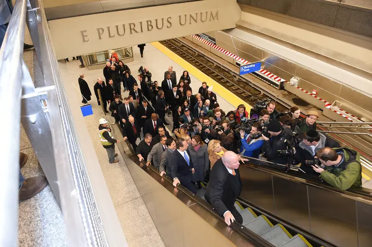
On Tuesday, news broke that the Port Authority of New York and New Jersey would not be holding a ribbon cutting ceremony when the World Trade Center Transportation Hub opens next week. They called Santiago Calatrava's project "a symbol of excess." Perhaps feeling the backlash from their decision, the agency sent out a press release yesterday saying that though there will still be no event to mark the opening on March 3rd at 3pm, they will hold a ceremony once the Hub is fully up and running this spring, according to the Wall Street Journal. They credit their change of heart to a desire to thank the thousands of workers who built the station. Additionally, Port Authority Chairman John Degnan said, "It will stand, along with the memorial, museum and the buildings themselves, as a tribute the resiliency of the region."
More this way
February 24, 2016

City Filth, Decoded: The Gunk on Subway Platforms Actually Has a Name

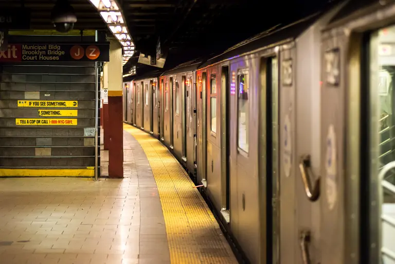
Do you ever wonder what that black schmutz that collects on the subway platform is? Has all the discarded chewing gum in the world begun to mobilize? What if I put my bag on it? Slate's What's That Thing column appropriately examines the phenomenon: After repeated unreturned phone calls to the MTA, the intrepid journalists got "Gridlock Sam" Schwartz and his transit gurus on the case. Finally the fine folks from the MTA rallied and gave name to the mysterious muck. According to NYC Transit assistant chief of the Division of Stations Branko Kleva, the stuff is mastic, a tar-like substance used to seal and waterproof the subway tunnels. When it heats up, (in the summer, for example, ironically from the heat generated by subway car air conditioning) it starts to "flow and drip down from the roof of the tunnel onto the platforms below."
More on the mysterious gunk...
February 24, 2016

How Far From NYC You Could Travel in One Day Between 1800 and 1934

Back in 1800, a New York stagecoach couldn't get outside the northeast, and a trip to Charleston, South Carolina took ten whole days of sailing—these are just two examples of just how arduous traveling in the 19th and early 20th centuries was. To visualize this difficulty, as well as to show the major advances made over a relatively short time, Quartz created this simple map that shows how far from NYC one could travel in a day between 1800 and 1934.
More on the map
February 24, 2016

Poll: Do You Agree With the Decision to Forego a Ribbon Cutting for WTC Transportation Hub?

Yesterday the Port Authority announced that they won’t be holding a ribbon cutting ceremony (or any type of celebratory event, for that matter) to mark the opening of Santiago Calatrava’s World Trade Center Transportation Hub next month. They called the Hub “a symbol of excess” and cited the exorbitant $4 billion price tag as the […]

February 23, 2016

There Will Be No Ribbon Cutting for the WTC Transportation Hub Opening

When the subject of Santiago Calatrava's World Trade Center Transportation Hub comes up, what's most likely to come to mind is not the flying-bird-looking architecture, but the fact that it was so incredibly delayed (it’s six years off schedule) and over-budget (final construction costs ring in around $4 billion in taxpayer dollars, twice what was projected, making it the world’s most expensive train station). The latter is not sitting well with the Port Authority of New York and New Jersey, who oversee the hub, as they've announced that they will not host an event to mark the opening during the first week of March, calling it "a symbol of excess," according to Politico. Similarly, Governors Christie and Cuomo, who control the agency, have declined to commemorate the opening.
Get the scoop
February 23, 2016

Minimalist Subway Map Posters Are More About Beautiful Design Than Finding Your Way

Cartographer Andrew Lynch has spent a lot of time looking at the NYC subway system. The CUNY Hunter alum recently perfected the entire system in a series of hypothetical but geographically accurate "Future NYC Subway" maps. But while studying the paths of the city's most important people mover, Lynch noticed they looked rather lovely, but just too, well, cluttered. From this thought came a series of colorful minimalist subway line posters (h/t CityLab) that Lynch calls "totally accurate, totally useless," but nice to look at nonetheless.
Get your own, this way
February 22, 2016

‘Fatal Flaw Analysis’ Says Brooklyn-Queens Streetcar Could Require Two New Bridges

The proposed Brooklyn-Queens Connector (BQX) streetcar may require the construction of two new bridges, one over Newtown Creek and another over the Gowanus Canal. The New York Times reported that the potential need for the new bridges–the Pulaski Bridge and the bridge across the Gowanus Canal at Hamilton Avenue might not be able to accommodate streetcars–was one of the more substantial details released by Deputy Mayor Alicia Glen and other top officials Friday. In a "fatal-flaw analysis," it was found that that though there would be "major challenges" to creating the system, it was feasible, Ms. Glen said. Like all things New York City, the proposed BQX proposal "would dwarf other recent streetcar systems in the United States." The cost involved in constructing the new bridges is already included in the project's $2.5 billion cost estimate. They would include bicycle and pedestrian paths.
Find out more
February 19, 2016

Dream Subway Map Includes a 10th Avenue Subway and a PATH to Staten Island

For most New Yorkers, subway dreams are simple things like trains arriving on time and getting a seat, but cartographer Andrew Lynch has big visions for what could become of NYC's transit system (h/t Gothamist). In his most recent iteration of the Future NYC Subway map, he "sought to plan out a system expansion which would be as cost effective as possible by addressing current service bottlenecks, train car issues, current ridership and population growth." This includes: a PATH train to Staten Island: a K line to connect the Brighton Beach Line (B/Q) to the Crosstown (G) at Bedford-Nostrand Avenues; a 10th Avenue L train extension; a majorly enhanced Second Avenue subway; and a Bushwick-Queens line.
The details on all these ideas
February 18, 2016

The Brooklyn-Queens Streetcar Would Run Entirely Through Flood Zones

Leading up to Mayor de Blasio's press conference on Tuesday about his proposed Brooklyn-Queens streetcar plan, the internet has been abuzz with criticism and concerns, including whether or not it will accept MetroCard transfers, how it won't really connect to existing subway lines, funding matters, and the issue that the system may favor "tourists and yuppies." But Streetsblog makes another very interesting point–the fact that the proposed route will run almost entirely through city- and FEMA-designated high-risk flood zones, which "raises questions about how the streetcar infrastructure and vehicles would be protected from storm surges, as well as the general wisdom of siting a project that’s supposed to spur development in a flood-prone area."
What does the Mayor have to say about this?
February 17, 2016

This Map Explains the Historic Tile Color System Used in NYC Subway Stations

We know the crowds that pack into our city’s subway cars each day are more than colorful enough, but the system also has a super-geeky color-coded navigation system that exists even outside of the main map’s primary colored lines. The city-owned Independent Subway was opened between 1932 and 1940. Up until 1967, it was the last of three former competing subway systems, and contributed six major lines to what is now the unified New York Subway: A, B, C, D, E, F, G, Q (partial). Squire J. Vickers, the system’s architect, designed a special color coding system for each station. Color coded stations were then grouped between express stations to make riders aware of the zone they were passing through. At each express station, the color of the tiles would change. Some station tile color patterns have been altered with subsequent renovations. The system map is based on the original color coding sheet from 1930. After WWII, almost all new subway stations featured their own unique architectural designs and colors
Find out what color your stop is
February 16, 2016

Waterfront Neighborhoods Fear Proposed BQX Streetcar Would Favor ‘Tourists and Yuppies’

Recent news has focused on plans announced by Mayor De Blasio for a streetcar line, dubbed the Brooklyn Queens Connector (BQX), to connect “underserved, but booming” areas of the boroughs. The city’s plan would run for 16 miles along the East River, from Astoria to Sunset Park, at a projected cost of $2.5 billion, serving bustling commercial hubs like the Brooklyn Navy Yard and Long Island City, as well as providing access for about 45,000 public housing residents. With concerns from local businesses and residents growing, the Times looks to the Hudson-Bergen Light Rail, an already-existing streetcar line in New Jersey that travels from Bayonne through Jersey City and Hoboken to Weehawken. It's been moving passengers for over a decade and today serves 46,800 passengers on a typical weekday. By most accounts it's been a success, helping employees get to work (with a skyline view, no less) and encouraging development in areas along the waterfront that had suffered from blight and neglect. Two rivers over, it's the areas through which the proposed "BQX" would travel that are the subject of some concern.
Find out more
February 9, 2016

Student Project Gets Subway Riders to Scratch and Sniff

"If You Smell Something, Smell Something Else." Those words introduce a handful of signs that have been popping up at a few subway stations around the city, including Canal Street, Herald Square and Union Square. And most people, quite frankly, would rather do just that, if they had a choice...and now they do. School of Visual Arts graphic design student Angela Kim was acutely aware of this fact, and she decided to add a few more to the collection.
What's that smell?
February 9, 2016

Mapping 22 Million Citi Bike Rides Across NYC

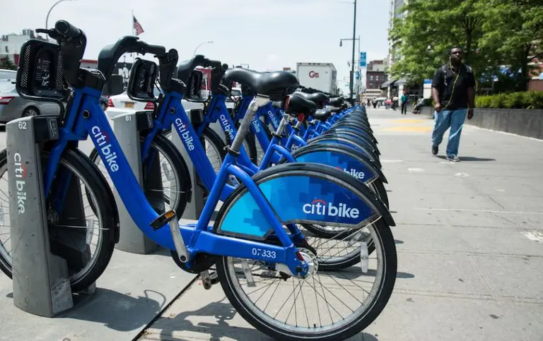
Software Engineer Todd W. Schneider is a super data geek in his spare time, analyzing New York City’s publicly available stats on topics like the transportation system. Recently, he took a closer look at the Citi Bike system (h/t Untapped), which clocked over 10 million rides in 2015–22.2 million rides from July 2013 through November 2015–making it one of the world's largest bike share systems. Schneider's findings spotlight general trends in Citi Bike usage and give us the big picture, via charts, maps and some fascinating animation, on the migrations and tendencies of our busy population of blue and white bikes.
See where all those bikes are going
February 5, 2016

Does the City’s Brooklyn-Queens Streetcar Plan Actually Make Sense?

Like most grand, government-backed plans, yesterday's announcement by Mayor de Blasio that he'd be supporting a proposed Brooklyn-Queens streetcar was met with flashy renderings and promises of how underserved areas and populations would finally get the access they deserve, as would booming commercial hubs like the Brooklyn Navy Yard and Sunset Park. But Streetsblog dug a little deeper and came up with several reasons why the $2.5 billion project doesn't quite add up.
Find out why
February 4, 2016

De Blasio to Announce $2.5B Brooklyn-Queens Streetcar Line

Earlier in the month, 6sqft shared news of a detailed proposal from non-profit advocacy group Friends of the Brooklyn Queens Connector that called for a Brooklyn-Queens streetcar line to connect "underserved, but booming" areas of the boroughs. The city must've been listening, because Mayor de Blasio is expected to announce today in his State of the City speech that he'll be backing such a proposal. Like the original scheme, the city's plan will run 16 miles along the East River, from Astoria to Sunset Park, but at a projected cost of $2.5 billion, it will be significantly more expensive than the previous estimate of $1.7 billion, but significantly less than a new underground subway. Not only would the streetcars serve bustling commercial hubs like the Brooklyn Navy Yard and Long Island City, but they'd provide access for about 45,000 public-housing residents.
More details
February 1, 2016

Why Is There a Sixth-and-a-Half Avenue in Midtown?

If you've never heard of it, that may be because this quarter-mile, pedestrian-only street is nearly hidden among the office towers of Midtown. Sixth-and-a-Half Avenue was the first fractional street in the city’s grid system, created in 2012 by the Department of Transportation to encourage people to use the public plazas and covered areas that form a path between 51st Street to 57th Street.
So where is it?
January 29, 2016

Interactive Graph Compares L Train Commute Times and Rents With Other NYC Neighborhoods

We're hearing lots of anguish and anxiety over the possibility of an L subway shutdown for repairs for as long as a year or more, and we've taken a look at some possible solutions. Now, we've asked the real estate data geeks at NeighborhoodX to go a little deeper beneath the grumbling to find out just how much convenience can be had along that thin grey line, and how it stacks up against other neighborhoods in Manhattan, Brooklyn and Queens. So which other neighborhoods offer commute times similar to the L train stops—and—just as important when choosing a neighborhood–how do their rents compare? And if you're living along the L, in light of the shutdown, what neighborhood alternatives do you have in the city that provide a similar commute?
Find out here
January 27, 2016

POLL: Will Open Gangway Subway Trains Be a Success in NYC?

New Yorkers are notoriously hard to impress, so it’s not surprising that some are finding fault with the MTA’s proposed open gangway subway trains, which are pretty much the norm everywhere else in the world. Despite the fact that they’ll reduce congestion and platform pileups, as well as reportedly increase safety, jaded city dwellers fear […]

January 26, 2016

Mapping World Cities That Already Have Open Gangway Subway Trains

Click here to enlarge map >> Just yesterday, the MTA revealed renderings of what their open gangway subway prototypes will look like. As 6sqft previsouly reported, when it was announced that the new trains got a $52.4 million piece of the MTA's capital plan, "This type of train, basically one long subway car with no doors in between, is popular all over the world, in most cities in China and Japan, in Berlin, Paris, and London, to name a few." So just how far behind the times is New York City? An informative new map from The Transport Politic, which plots the cities in which riders can walk between cars, says pretty far.
Find out more
January 21, 2016

Amtrak Estimates Penn Station and Hudson River Tunnel Projects Will Cost $24B

When Governor Cuomo announced his $3 billion revamp of Penn Station earlier this month, skeptics were quick to point out that all the glassy new structures and reconfiguration of waiting rooms won't do anything to help the fact that the Hudson River rail tunnels are crumbling. Clearly on the same page, Amtrak announced yesterday a detailed overview of the entire infrastructure project, and it comes in at a whopping $23.9 billion. According to the Times, "the largest share of about $7.7 billion [will go towards] building the new Hudson tunnel and repairing the existing tunnel. The project includes a host of other elements, including expanding Pennsylvania Station in Manhattan at an estimated cost of $5.9 billion, and replacing rail bridges in New Jersey."
Find out more
January 20, 2016

Top 10 Transportation Proposals That Would Transform New York City

Commuting in and around NYC can at times be a daunting task, and with the all of the pending subway closures, things are about to get a bit more complicated. However, all hope is not lost, and a trouble-free ride to work right be in the near future. From a city-wide ferry system to cell-phone friendly subway cars, both Governor Cuomo and Mayor de Blasio have several new initiatives in play to improve the city's infrastructure. In addition to these ambitious government-backed measures, there are also a slew of motivated residents looking to make some changes, including a 32-Mile Greenway in Brooklyn and Queens and a High Line-esque bridge spanning the Hudson River, just to name a few. To keep your spirits high when subway lines are down, we've put together this list of top 10 transportation proposals for NYC.
See all 10 here
January 20, 2016

Are Shuttle Buses a Viable Alternative to the L Train During a Shutdown?

The MTA’s announcement of possible plans to close the L train for months or even years at a time to repair the Hurricane Sandy-damaged Canarsie Tunnel has businesses scrambling and commuters (the train has 300,000 riders on the average weekday) fearful. Data mapping company CartoDB offers a bit of “location intelligence” to better understand the consequences of a shutdown for people living in Brooklyn and, more importantly, what some realistic alternatives to the L train might be. For example, shuttle buses: "If the shuttle bus takes 20 minutes, we are able to calculate the best choices for riders along the L needing to get to Manhattan. Should they go all the way to Lorimer and take the shuttle bus or should they transfer earlier at Myrtle-Wyckoff to the M train or at Broadway Junction to the A?"
Will shuttle buses save the day?
January 19, 2016

Confirmed: Calatrava’s WTC Transportation Hub Will Open First Week of March!

The Port Authority has announced today in a press release that the World Trade Center Transportation Hub—anchored by architect Santiago Calatrava's Oculus–will open the first week of March. The hub will link the World Trade Center PATH station and "enable travelers to have a seamless connection with 11 New York City subway lines and the East River ferries in addition to access to PATH trains."
What about the mall?
January 15, 2016

Study Suggests Competition From Uber May Curb Cabbie Rudeness

Is the rise of car share services like Uber and Lyft making taxi drivers nicer? The Washington Post reports that according to research presented this week by the Technology Policy Institute's Scott Wallsten, complaints are down in New York and Chicago, including those about general rudeness, busted A/C, and that bit about the credit card machine not working. The drop in complaints corresponds with the rise of availability of Uber and Lyft in those cities, they claim.
What are New Yorkers complaining about less