Taxi map shows where New Yorkers take cabs and how they pay for them
Images: Esri Taxi Cab Terrain map
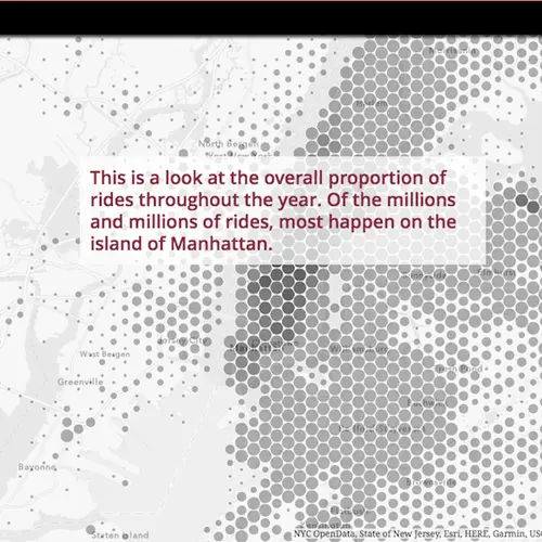
Looked at from any distance, New York City may appear to be a honking sea of cars and taxis, with the latter making the biggest visual impact (and probably doing the most honking). Thanks to GIS gurus Esri via Maps Mania, we have a snapshot–an aggregate vision, if you will–of a year of life in the Big Apple made up of the city’s taxi journeys. The Taxi Cab Terrain map allows you to zoom in and find out about the many millions of rides that start and end in the New York City and New Jersey metro areas based on data from the NYC Taxi & Limousine Commission. Mapping yellow cab travel data covering July 2015 to June 2016, the map shows how different NYC boroughs use taxis and how they pay for their rides. Esri’s John Nelson then takes a look at socioeconomic data to look for influences that might impact how different neighborhoods use and pay for cab rides.
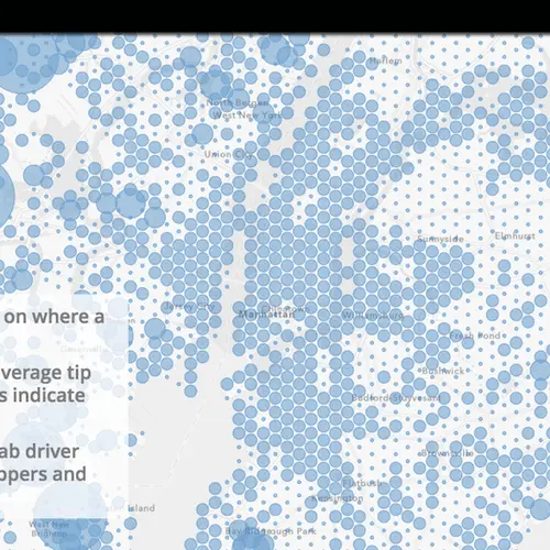
The map shows the locations where the most New York cab rides begin, pick-up spots where cab drivers can expect the heftiest tips, where passengers pay in cash, and where they’re more likely to pay with credit. We also can find the number of passengers and the length of their journeys.
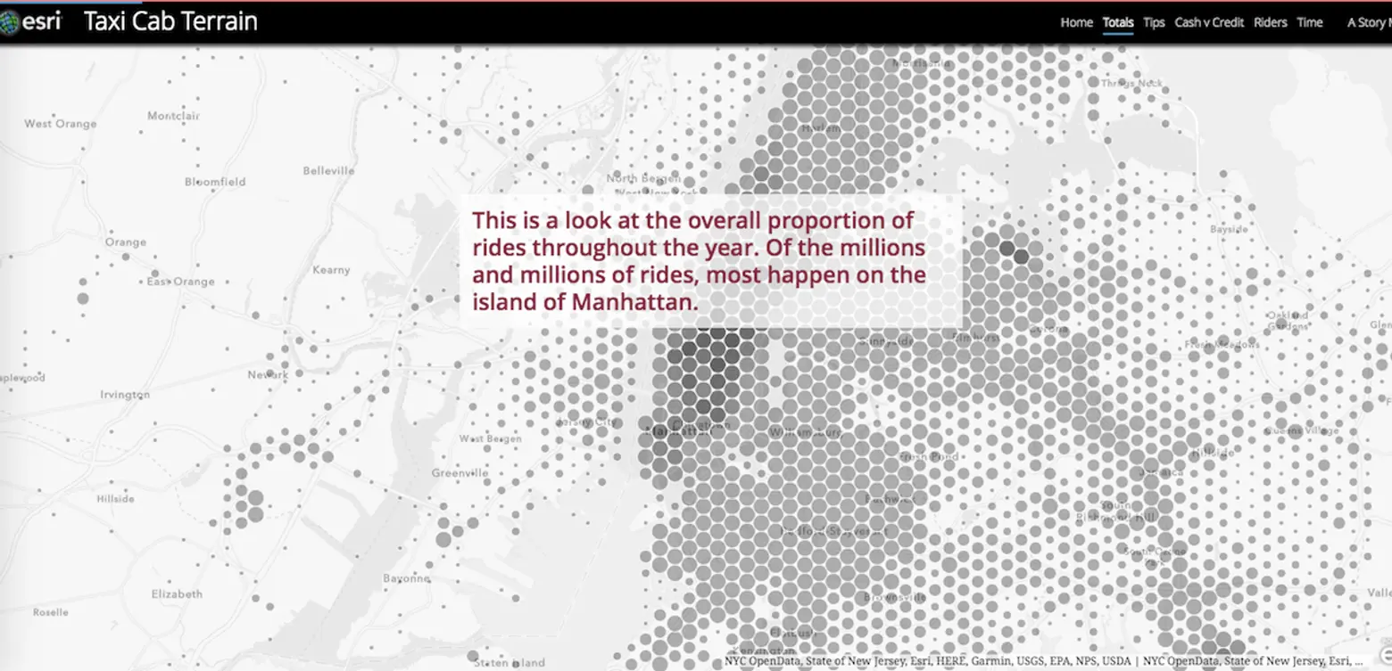
Some things are more obvious with or without a map: The majority of taxi action happens on the island of Manhattan. And La Guardia Airport and JFK airports are popular pickup spots (travel in and out of JFK is cab-heavy, too, unsurprisingly).
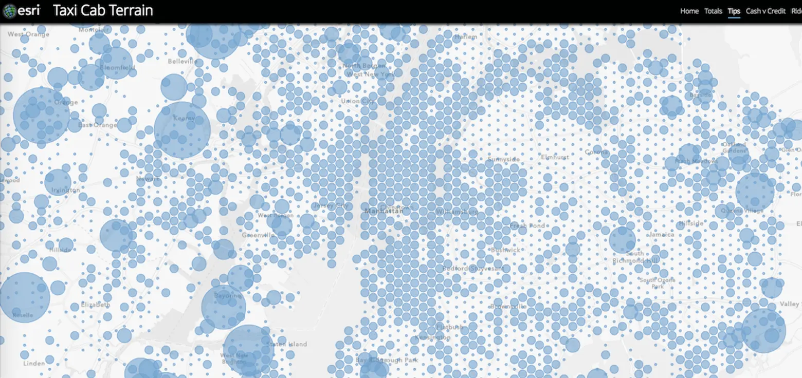

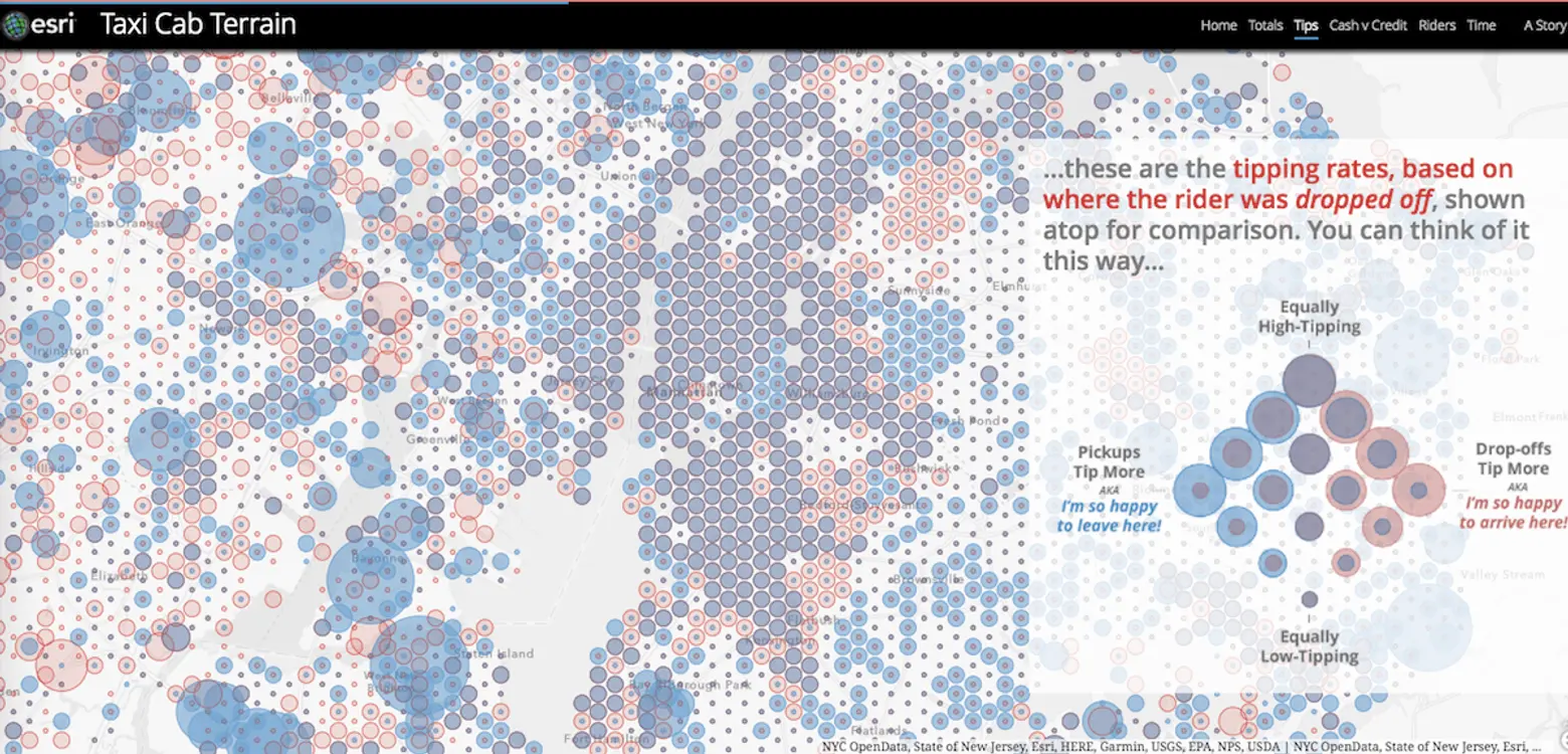
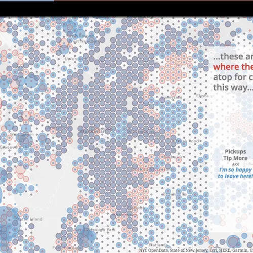
On the topic of tipping, the map looks at the data from each cab ride based on the location of its origin and its final destination–both provide insights on how the city moves. Based on the location of pickup, cabbies can expect unusually big tips when picking up in Bayonne, NJ, Staten Island–and basically nowhere in Manhattan, Hoboken or most of Brooklyn where tipping appears to be fairly consistent at about 11 percent, according to the map. Pickups in the Bronx can dip to five percent gratuity. Tips in northwest Queens neighborhoods range between 5 and 10 percent, and bands of higher tipping show up around La Guardia and along Grand Central Parkway.
Looking at drop-off data, things don’t change much in Manhattan; in some Queens neighborhoods, though, arrivals and departures diverge as far as how much they’re willing to shell out. Astoria and Forest Hills drop-offs tip more generously than riders who start their meters there. And, interestingly, riders leaving LaGuardia and along the Grand Central Parkway area give heftier tips than those who arrive there.
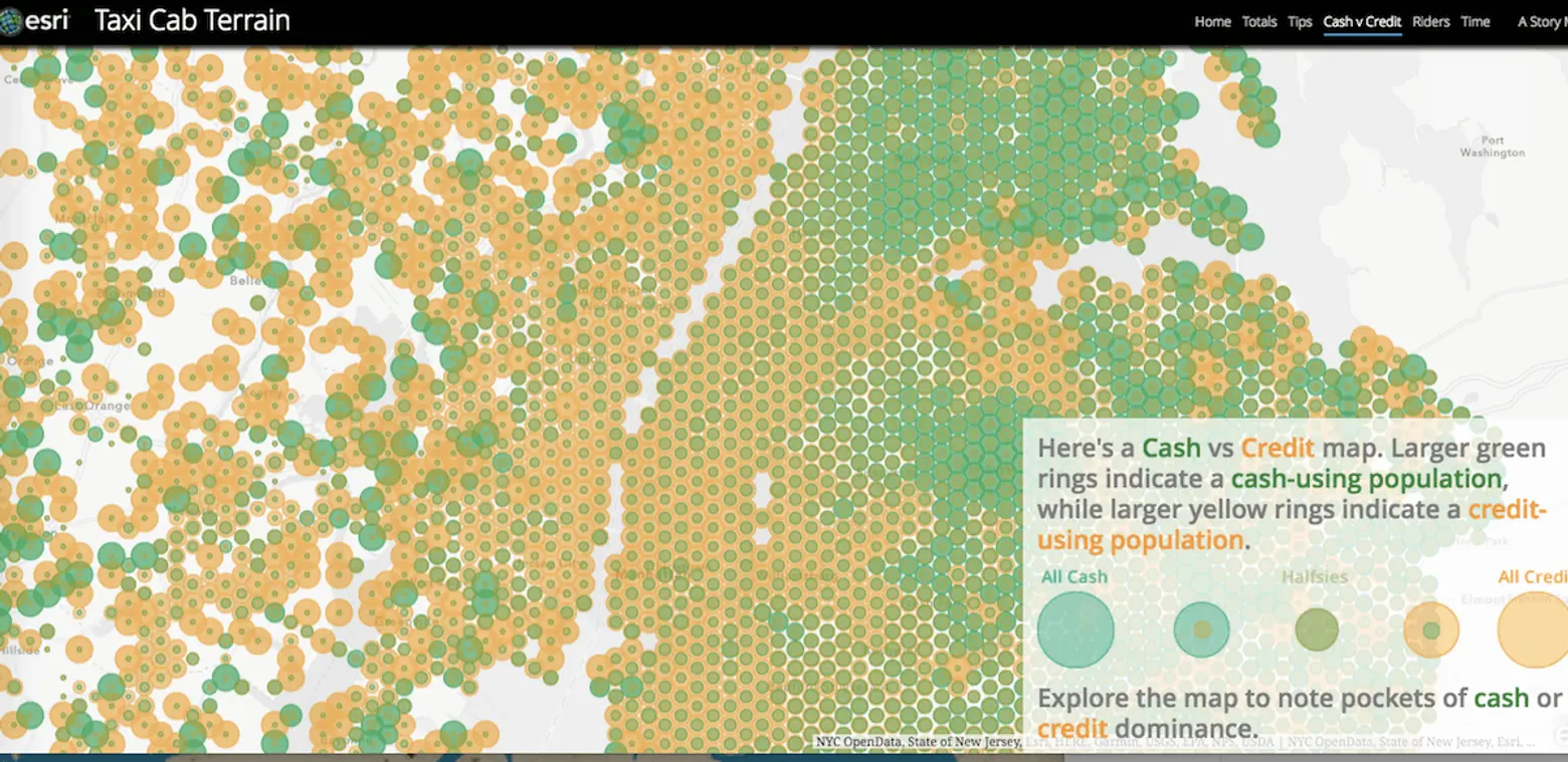
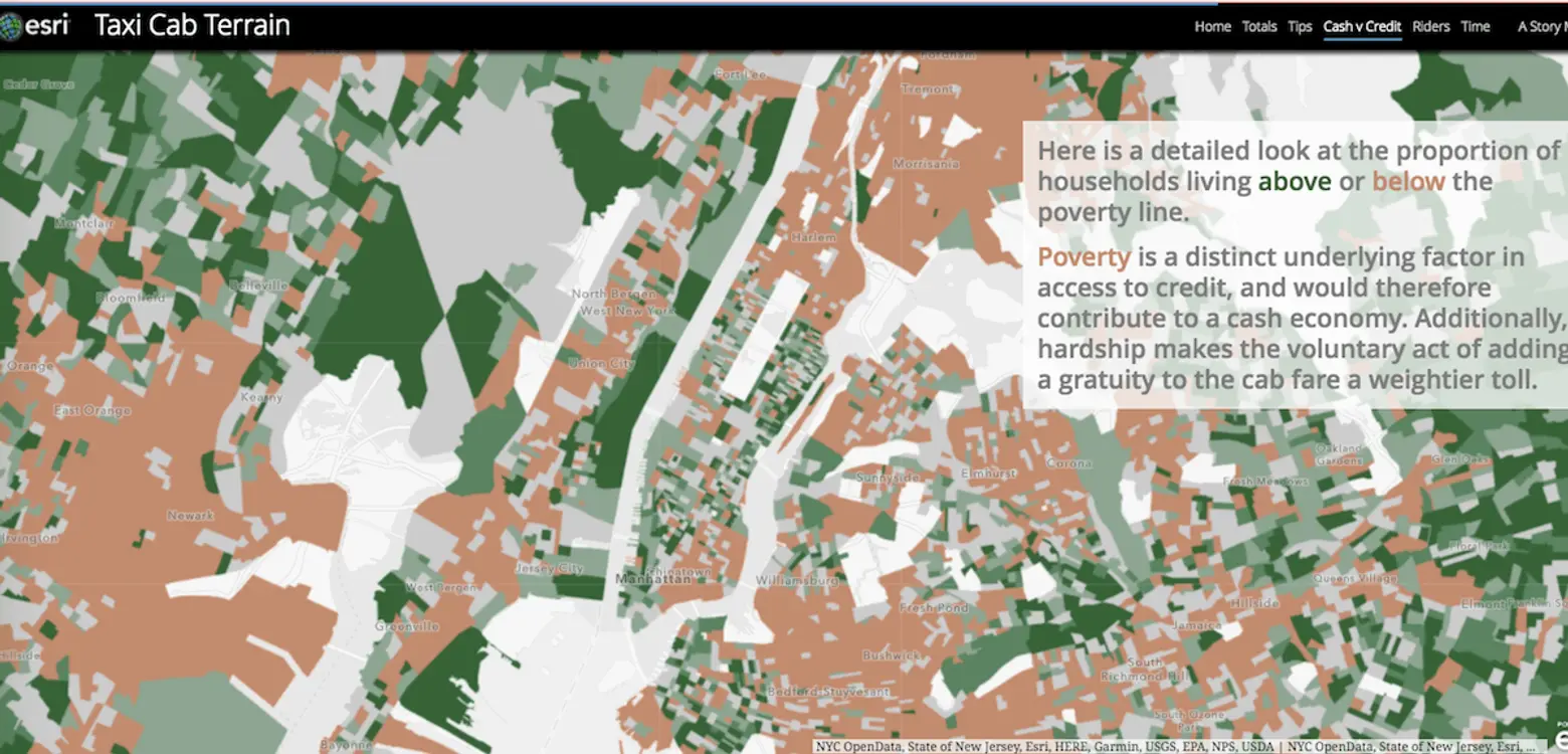
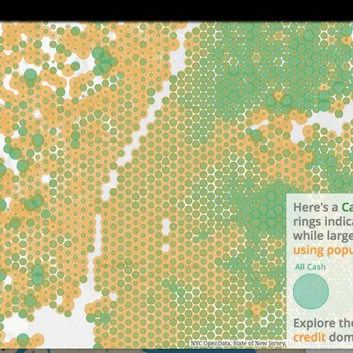
Cash or credit? According to map data, Manhattan and “bridge-linked neighborhoods,” as well as coastal New Jersey and Staten Island mostly paid with a credit card as did areas around the airports the roadways between them. On the other hand, Brooklyn and portions of Queens paid cash about 80 percent of the time, as did neighborhoods in southwestern Queens.
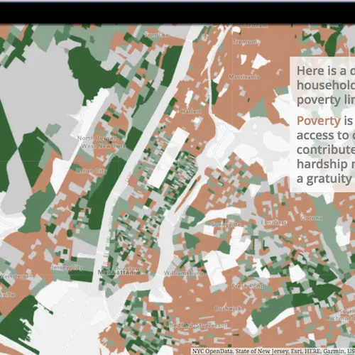
The map’s author indicates that, “There appears to be a strong correlation between the use of cash and lower rates of tipping shown in the previous section. This could be the be due to the tendency of people to spend more judiciously when a tangible, rather than virtual, currency is used. But a look at underlying social data tells us there is another, stronger, force at work…” A map overlay shows neighborhood households above or below the poverty line. “Poverty is a distinct underlying factor in access to credit, and would therefore contribute to a cash economy. Additionally, hardship makes the voluntary act of adding a gratuity to the cab fare a weightier toll.”
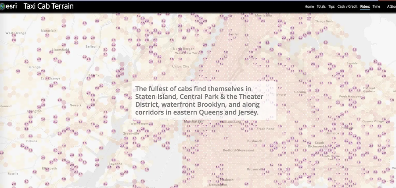
Additional data we can learn includes how many passengers try to pack into a cab, with the biggest crews attempting to roll together in Staten Island, Central Park and the Theater District, waterfront Brooklyn, and along corridors in eastern Queens and Jersey, and duration of rides, with people leaving the airport spending an average of over an hour in transit and most quick hops happening in Manhattan.
Check out the map for yourself, if only to remember next time you’re counting the minutes of an endless airport taxi run: you’re not alone out there.
[Via Maps Mania]
RELATED:
Explore NYC Virtually
Leave a reply
Your email address will not be published.








They should download the taxi app E-HAIL (www.goehail.com) it will be easier to compete with Uber if they do!