For $125K, you can buy the first map to credit Henry Hudson
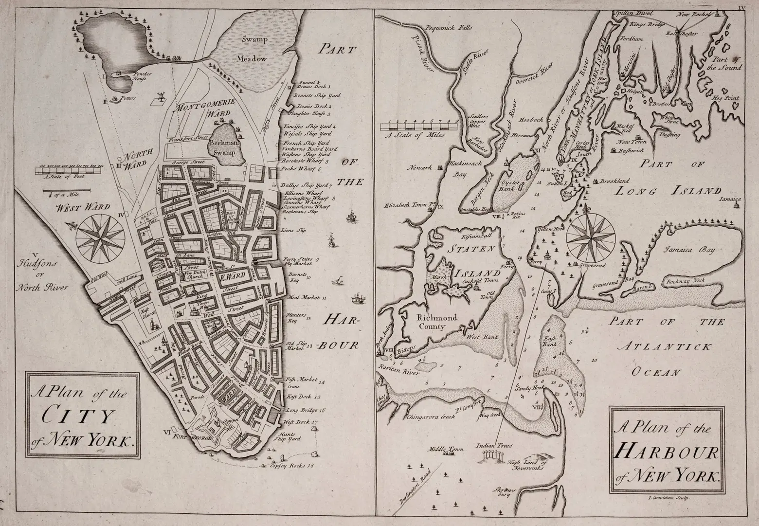
Photo courtesy of Martayan Lan Rare Maps & Books
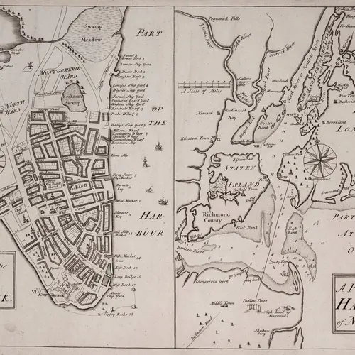
This weekend, head over to the New York Antiquarian Book Fair, located at the Park Avenue Armory, where the first map to credit Henry Hudson with navigating his nominative river will be on display (h/t NY Times). The map, the third engraving of its kind known to exist, is being sold by Robert Augustyn, who owns Martayan Lan Fine Antique Maps, Atlases and Globes in Manhattan. The minimum asking price for the 12-by-17 inch, 280-year-old map? $125,000.
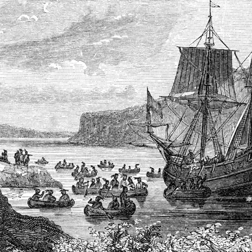
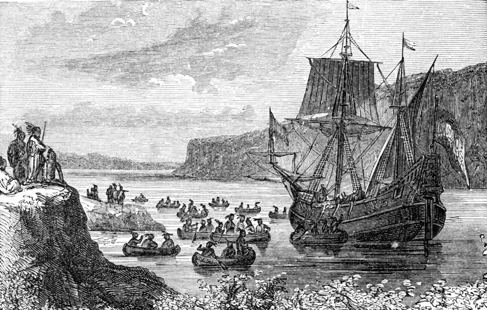 Henry Hudson sailed the Halve Meen (or Half Moon) into New York Harbor in September of 1609
It took until 130 years after the Dutch surrendered New Amsterdam to the English for Hudson to receive credit for sailing the river. In the book “Manhattan in Maps 1527-2014,” Robert Augustyn and Paul Cohen write: “The use of his name would have lent support to Dutch territorial claims. However, by the time this map was drafted, the Dutch had long been in eclipse and so the English evidently felt secure enough to give Hudson his due.”
The map, called the Carwitham Plan, named after the cartographer, John Carwitham, is considered as the second-earliest printed plan of the city and the harbor, based off of an earlier 1730 plan.
In addition to crediting the explorer, the map stretches farther north than the previous map and includes the synagogue on Mill Street in Lower Manhattan, the first depiction of a synagogue in North America. Also included, the Dutch Church on Garden Street in Manhattan and the Presbyterian Church on Wall Street. The plan also signified oyster beds near what later became known as Ellis and Liberty Islands.
[Via NY Times]
RELATED:
