Interactive Map Shows Massive ‘Subway Deserts’ in Underserved ‘Hoods
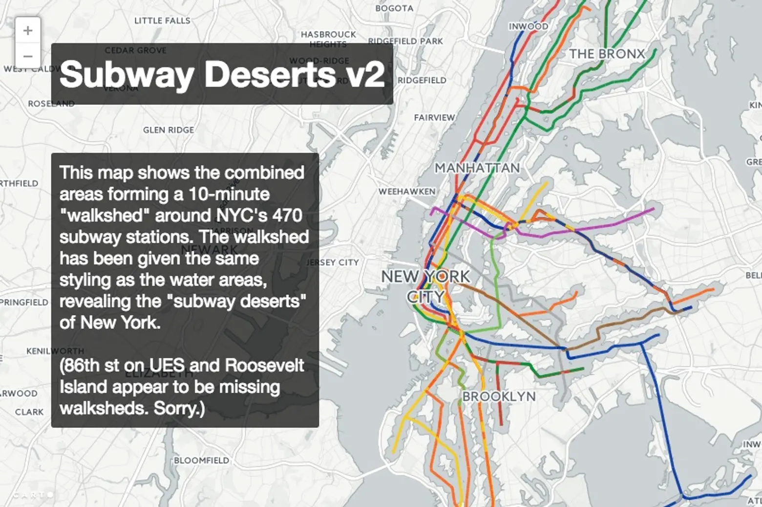
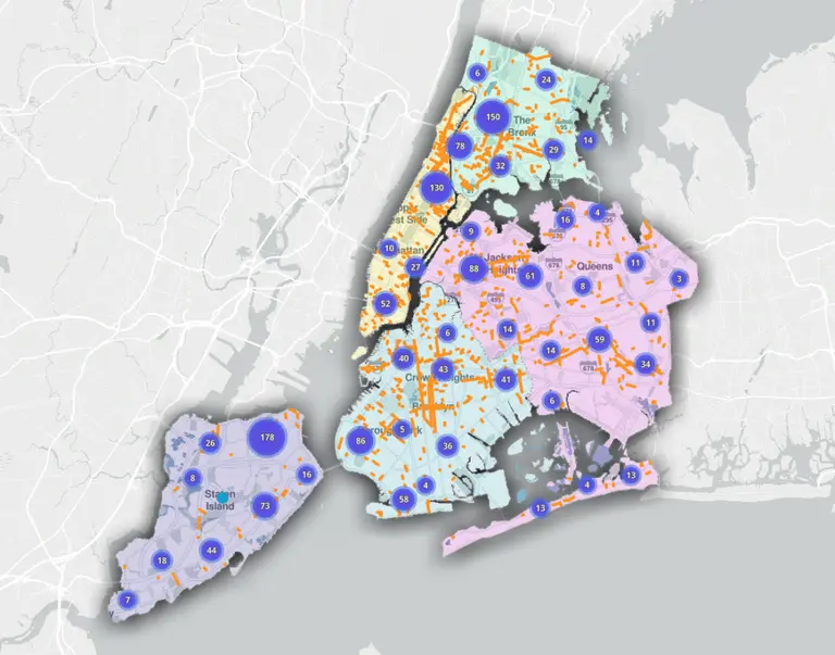
Last summer, 6sqft shared an interactive map from transit data junkie Chris Whong that laid out all NYC land ares more than 500 meters from one of the city’s 470 subway stations. He’s now revised his Subway Deserts Map to better take into account walkability, using a 10-minute walk from a station as the buffer zone (h/t Gothamist). The “walkshed” is styled in the same hue as water, leaving only the map portions that are subway deserts. Not surprisingly, Manhattan is pretty well set, save for Alphabet City and the far east and west sides, and the majority of the Bronx is underserved, as is much of Queens, southeast Brooklyn, and the Williamsburg waterfront.
Whong works for the Department of City Planning, where he does data analysis and makes maps. For his Subway Deserts Map, which he made for fun in his free time, he utilized data from the Department of Information Technology and Telecommunications, OpenStreetMap, and OpenTripPlanner. He said the map gave him a new appreciation for living so close to a subway stop and hopes that it’ll prompt New Yorkers to visit some of these less accessible neighborhoods.
[Via Gothamist]
RELATED:

