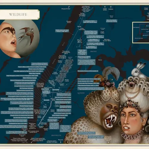
The arty maps of ‘Nonstop Metropolis’ show NYC the way locals experience it

When writers and artists–particularly ones who have a keen understanding of cities–venture into the world of maps, you can bet the results will be fascinating and illuminating. “Nonstop Metropolis,” a new atlas by Rebecca Solnit and Joshua Jelly-Schapiro (6sqft recently discovered the “City of Women” subway map from the book) offers 26 New York City maps that “cue us into understanding who is here” according to Solnit. As Wired puts it in their review, the result is “a diverse array of deeply particular maps” that combine imaginative and fanciful imagery with the colorful cultural history beneath the city’s diverse neighborhoods and landmarks and the people who live among them.
The new “Nonstop Metropolis” is one volume in Bay Area resident Solnit’s map trilogy that includes San Francisco-based “Infinite City” and the 2013 New Orleans atlas “Unfathomable City” (with co-author Rebecca Snedeker). Solnit compares those cities for their ability to attract the fabulous and fascinating: “These cities are generative of people who come out of the closet or become doctors or dancers, but they’re also generative of new ideas about how we live our lives.” In the trilogy, Solnit, Snedeker, and Jelly-Schapiro present 70 personal cartographies, making the point that there are so many more: “San Francisco has at least 800,000 ways of being mapped, New York has eight million,” according to Jelly-Schapiro.
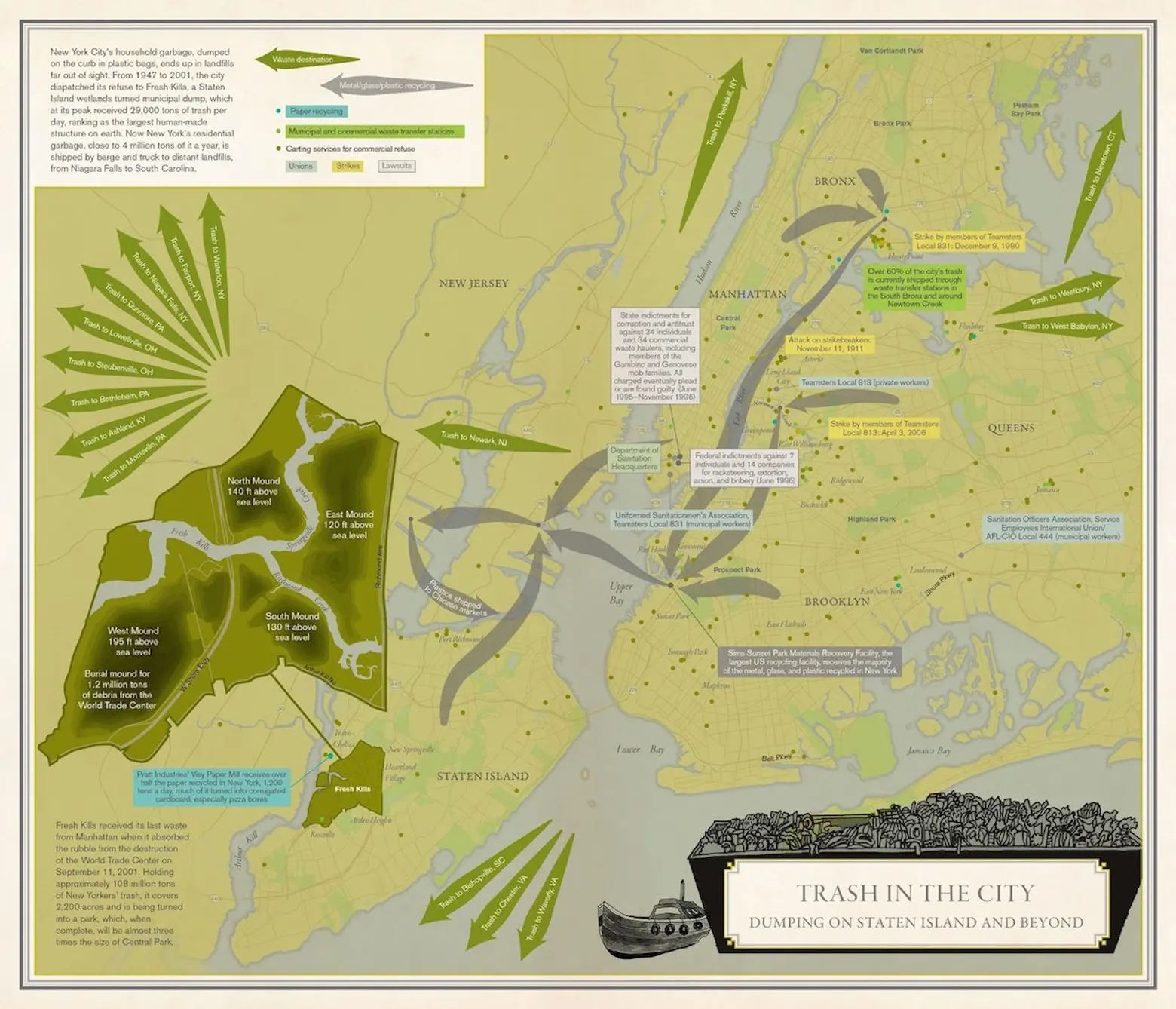
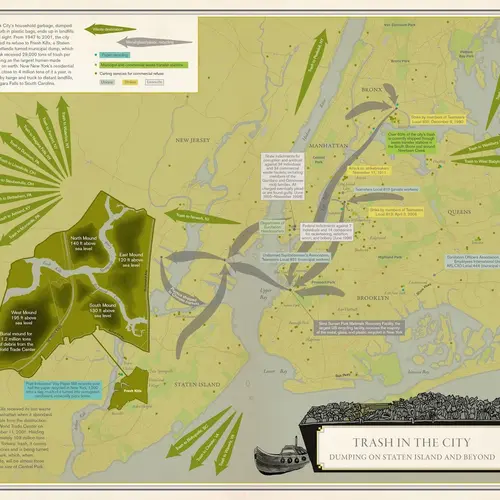
Trash in the City: Dumping on Staten Island and Beyond; Cartography: Molly Roy; Artwork: Linnea Russell
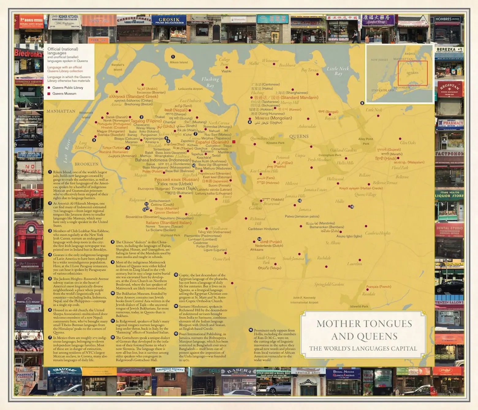
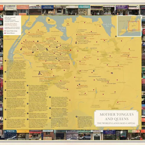
Mother Tongues and Queens: The World’s Languages Capital; Cartography: Molly Roy; Photographs: Mirissa Neff
To cover NYC in all its quirky glory, the authors consulted local historians both informal and professional; it wasn’t hard, according to the authors, to find folks who are happy to talk about why their city is the greatest on Earth. Says Jelly-Schapiro, “Whatever odd ephemeral knowledge we’re interested in, there’s someone here who’s made a career out of it.”
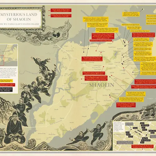
The resulting atlas offers landscapes as diverse as the subcultures that inhabit them, such as “Mysterious Land of Shaolin: The Wu-Tang Clan’s Staten Island,” and “Oscillating City,” which simply tracks the city’s commuters like so many bees circling a hive. Essays and interviews provide context.
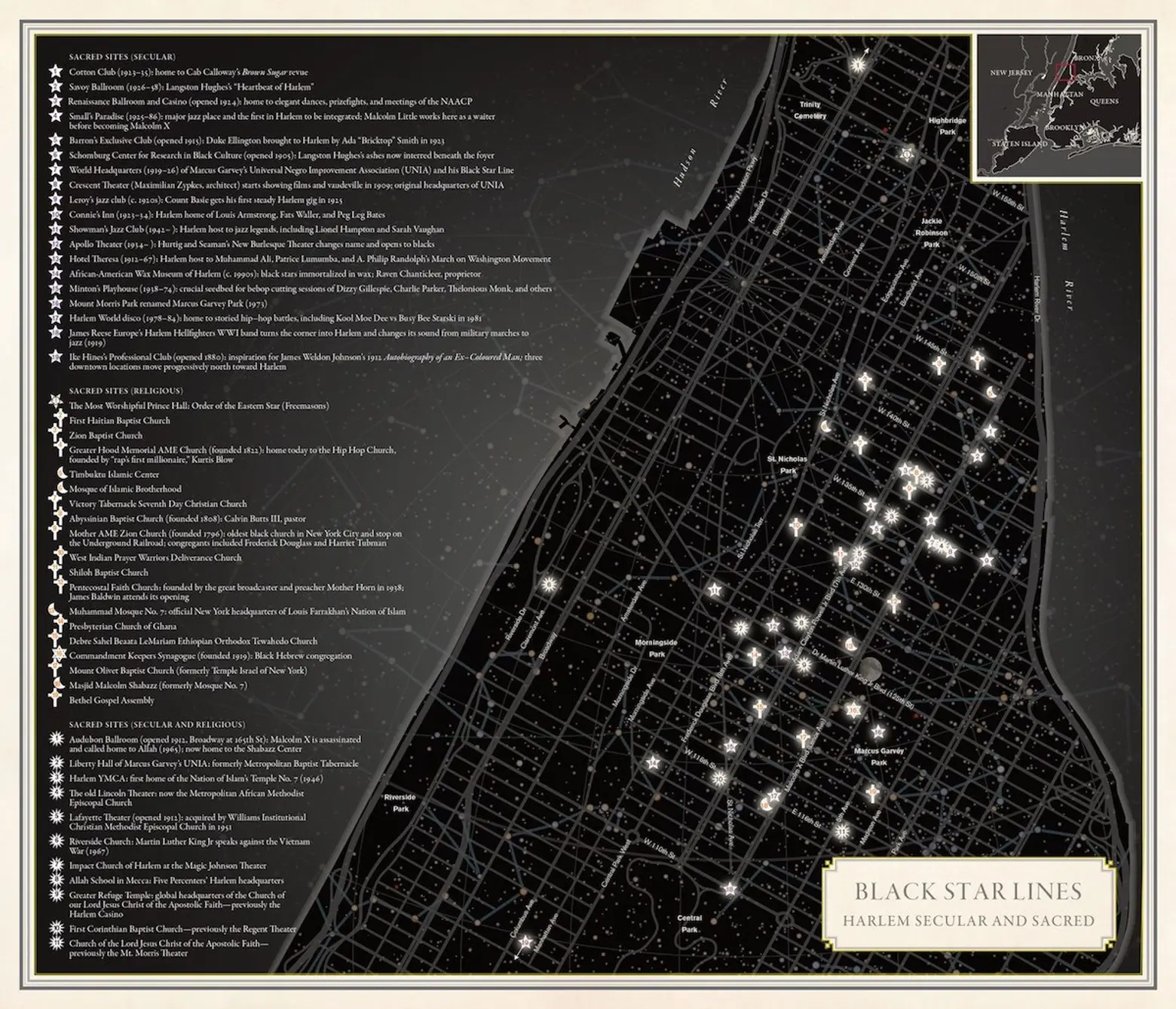
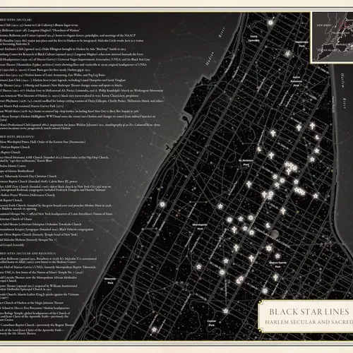
Black Star Lines: Harlem Secular and Sacred; Cartography: Molly Roy
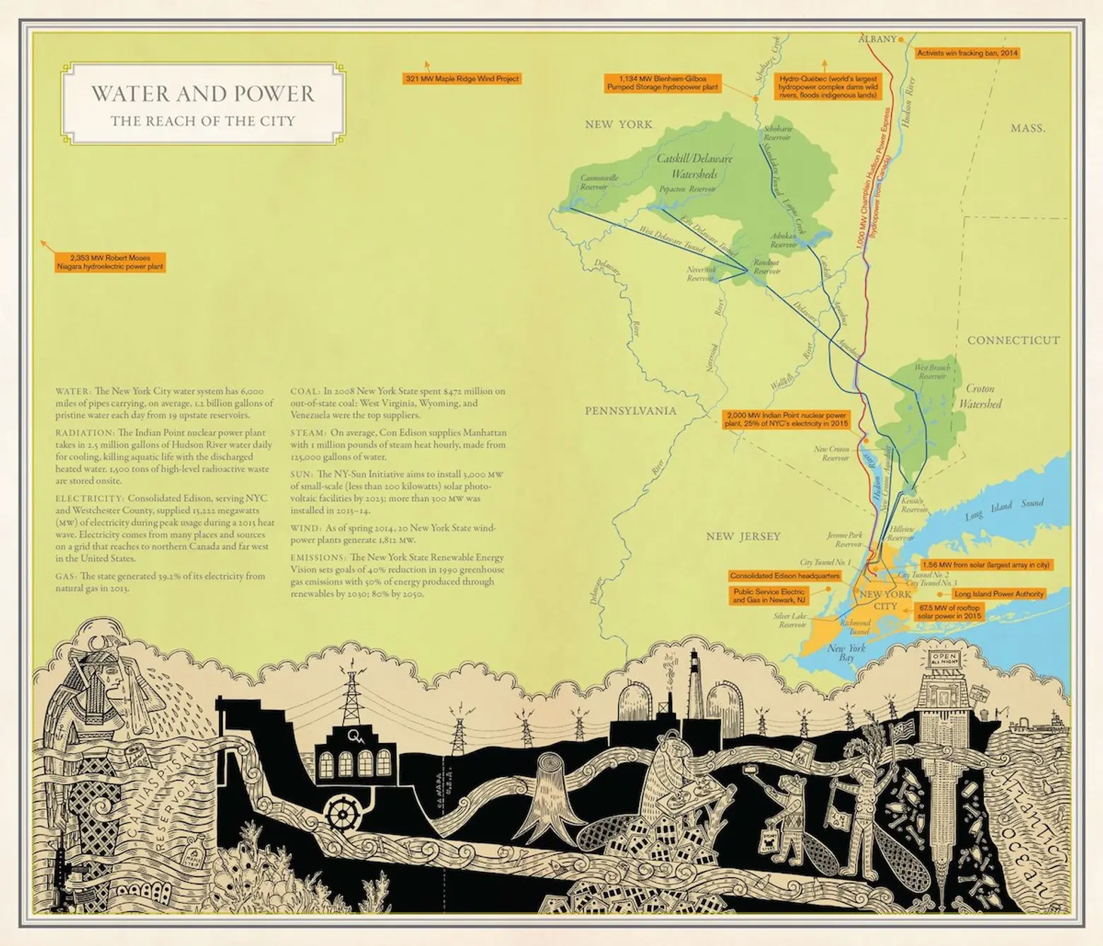
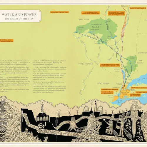
Water and Power: The Reach of the City; Cartography: Molly Roy; artwork: Duke Riley
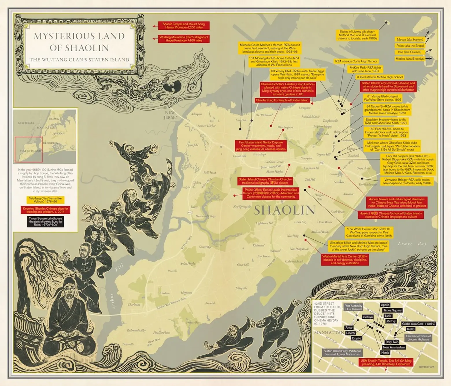
Mysterious Land of Shaolin: The Wu-Tang Clan’s Staten Island; Cartography: Molly Roy; Artwork: Peach Tao
A constellation of contributors includes Bronx hip-hop pioneers Grandmaster Caz and Melle Mel, author and book critic Luc Sante, graffiti artist Lady Pink, and urban planning professor Thomas Campanella, to name just a few.
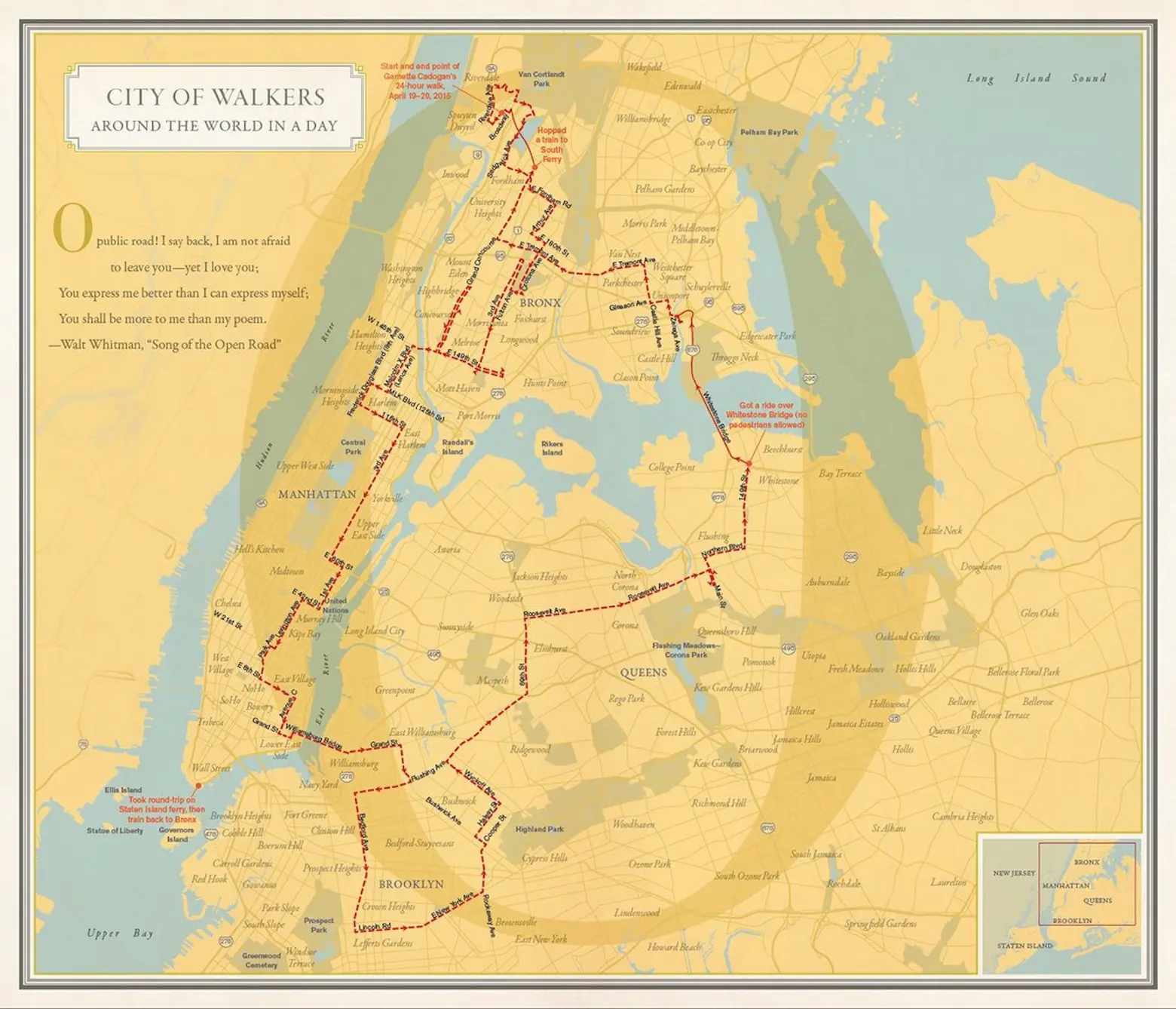
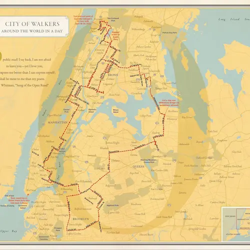
City of Walkers. Cartography: Molly Roy
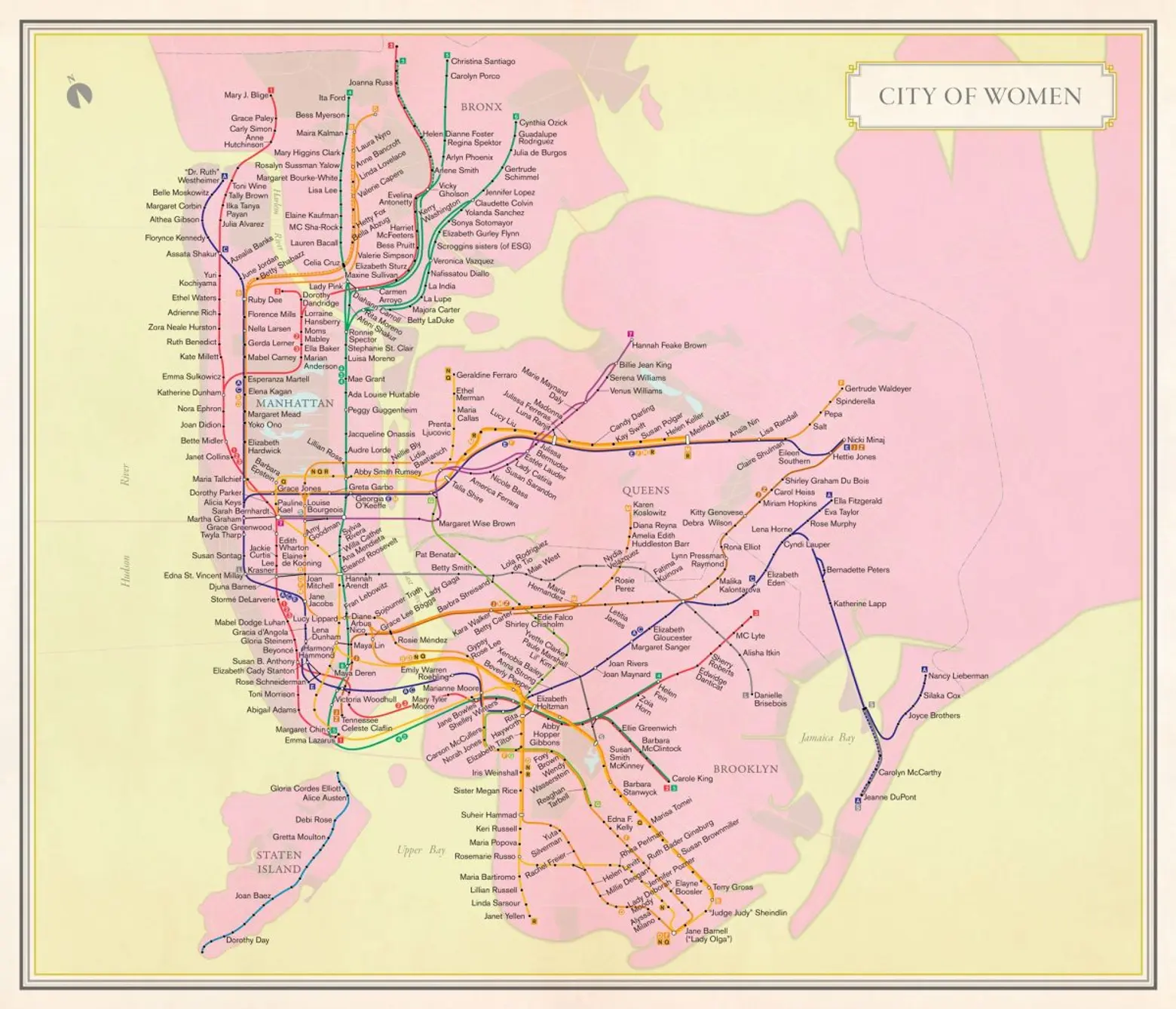
Map via Molly Roy, from “Nonstop Metropolis” by Rebecca Solnit and Joshua Jelly-Schapiro. Subway route symbols ® MTA.
Says Solnit about our fascination with maps, the more personal the better: “We have this desire for orientation—each promises that you might at least know where you are, in some metaphysical or practical way.”
[Via Wired]
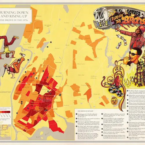
Lead image: Burning Down and Rising Up: The Bronx in the 1970s. Cartography: Molly Roy; Artwork: Lady Pink
RELATED:
- ‘City of Women’ turns the subway map into an homage to the city’s greatest females
- Interactive graphic explores the diversity of Queens through its 59 endangered languages
- The New York Music Map Matches 450 Artists With a Special Spot in the City
- Chatty Maps Tell You What You’ll Hear on Given Streets and How It’ll Make You Feel
